Getting Your Bearings
Bushwick sits in the northern part of Brooklyn, bordered by Ridgewood, Queens, to the northeast; Williamsburg to the northwest; the cemeteries of Highland Park to the southeast; and Bedford–Stuyvesant to the south and southwest. The neighborhood's borders largely overlap those of Brooklyn Community Board 4, and the industrial area north of Flushing Avenue, east of Bushwick Avenue, and south of Grand Street is often considered either East Williamsburg or part of Bushwick. For a visitor, the practical takeaway is that Bushwick blends into its neighbors, so you can easily walk or ride from one into the next.
How Tourists Move Around the City
New York City's transit network is the backbone of visitor movement, and Bushwick is well served by it. The subway is the fastest way to cover long distances, especially across the East River into Manhattan. Buses fill in the gaps for shorter, more local trips. Walking is often the best way to explore a neighborhood once you've arrived. Taxis and ride-hailing services are available for direct, door-to-door trips. For most visitors, a combination of subway, bus, and walking covers nearly everything.
Rail, Metro, and Tram Network
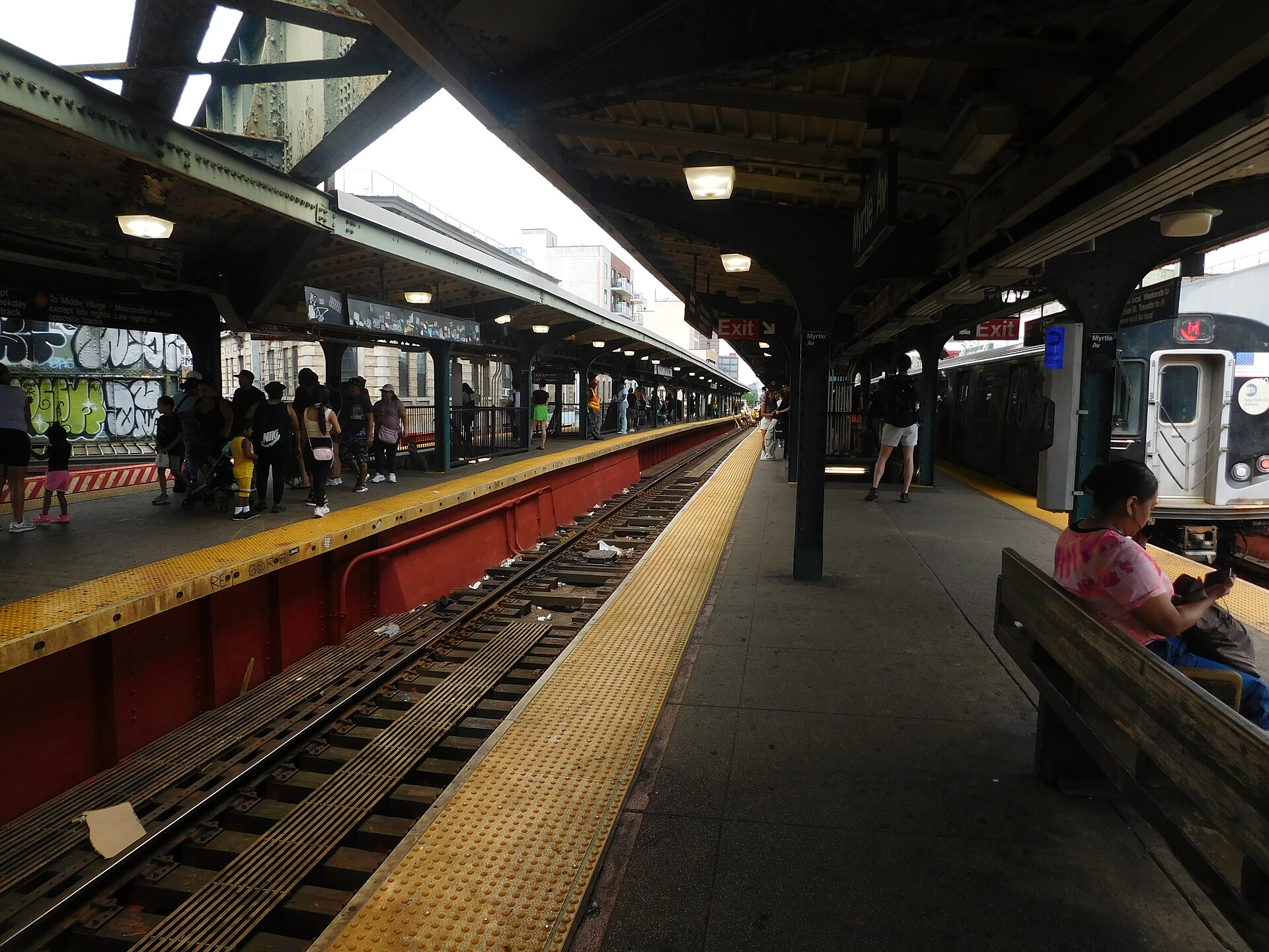
New York City's rail transit is the subway system, operated by the MTA. Bushwick is connected to the broader network, and the subway is generally the quickest option for reaching Downtown Brooklyn and Manhattan. As one example of how the network functions, the M/F trains connect the Myrtle–Wyckoff area of Bushwick to Jay Street–MetroTech in Downtown Brooklyn in roughly half an hour, though that route requires crossing the East River and back. The subway runs throughout the day, making it the most reliable option for longer journeys.
Buses and Other Public Transport
Buses are a practical complement to the subway, particularly for trips that don't follow rail lines. The B54 bus runs along Myrtle Avenue, connecting Bushwick toward Downtown Brooklyn; at rush hour, that trip can take around fifty minutes. Brooklyn also has Select Bus Service (SBS) routes, a form of bus rapid transit that uses dedicated lanes and other street treatments to speed up trips. Existing Brooklyn SBS routes include the B44 (Williamsburg to Sheepshead Bay) and the B46 (Bedford-Stuyvesant to Kings Plaza and Marine Park). The MTA has proposed an SBS route between Downtown Brooklyn and Bushwick, running from Jay and Tillary streets to Myrtle and Wyckoff avenues, with candidate streets including Flushing, Park, Myrtle, Lafayette, DeKalb, and Willoughby avenues. If it moves forward, it would add a faster bus option on a corridor the MTA identified as needing bus rapid transit.
Taxis and Ride-Hailing
Taxis and ride-hailing services offer direct, door-to-door trips and are useful when you're carrying luggage, traveling late, or heading somewhere not well served by transit. They're a flexible option for crossing between Bushwick and other parts of Brooklyn or Manhattan, though travel times vary with traffic. For visitors, they're best treated as a convenience rather than the primary way to get around.
Walkability
Bushwick is a walkable neighborhood, and walking is often the most enjoyable way to take it in. The neighborhood's borders are defined by nearby areas—Ridgewood to the northeast, Williamsburg to the northwest, Highland Park's cemeteries to the southeast, and Bedford–Stuyvesant to the south and southwest—so it's easy to wander from Bushwick into adjacent neighborhoods on foot. The geographic center of New York City is located on Stockholm Street in Bushwick, on the block between Wyckoff and St. Nicholas Avenues, a fun landmark to seek out on a walk.
Getting from the Airport into the City
Visitors arriving by air typically reach the city via the region's major airports, then continue by public transit, taxi, or ride-hailing. The subway and bus network connects the city to its airports, and taxis and ride-hailing are also available for direct transfers. Once you're in the city, the same subway, bus, walking, and taxi options described above will get you to Bushwick. Because airport connections and fares can change, it's worth checking the current options when you arrive.
Practical Tips
- Use the subway for longer trips, especially across the East River into Manhattan and Downtown Brooklyn.
- Use buses like the B54 for local trips along corridors such as Myrtle Avenue.
- Watch for Select Bus Service routes (such as the B44 and B46) when you want a faster bus trip.
- Walk to explore Bushwick and to cross into neighboring areas like Williamsburg, Ridgewood, and Bedford–Stuyvesant.
- Keep taxis and ride-hailing in mind for luggage-heavy or late-night trips.
- From the airport, choose among public transit, taxi, or ride-hailing based on your destination and budget.