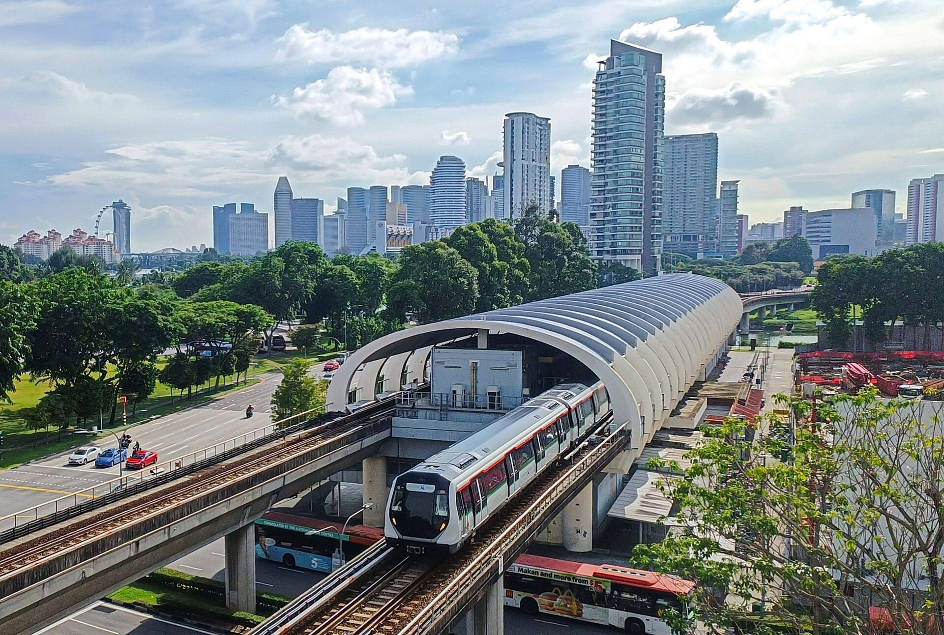
Getting Your Bearings in Kallang
Kallang sits in the Central Region of Singapore, built around the Kallang River, the country's longest waterway. For a visitor, that central position is the main practical advantage: the area borders the Downtown Core to the southwest, Rochor and Newton to the west, Geylang to the east, and Marina East to the south. Several districts visitors often treat as separate destinations — Little India and Kampong Glam among them — spill over into Kallang, so you may find yourself crossing into the planning area without noticing. The modern landmark anchoring the area is the Singapore Sports Hub, home to the National Stadium and the Singapore Indoor Stadium, which sits on the eastern bank of the Kallang Basin.
How Visitors Get Around Singapore
Singapore's public transport is built around a metro system, an extensive bus network, and app-based ride-hailing, all of which work together with a single payment card. The practical rhythm to plan around: trains run from roughly the early morning until around midnight, with a slightly later finish on some nights. Off the rails, buses fill in the gaps the metro does not reach, and taxis and ride-hailing cover late nights and door-to-door trips.
One habit makes everything easier: use the same fare card or contactless bank card across both metro and buses. You tap in and tap out on both, and forgetting to tap out means you are charged a maximum fare. Eating, drinking, and even carrying durian on the metro are prohibited, with fines attached. Air-conditioning on the trains is strong, so a light layer is worth carrying.
Rail and Metro
The metro — known locally as the MRT — is the backbone of visitor movement. It is a multi-line system, with each line colour-coded and named, and it connects the airport, the city centre, and the major outlying areas. Fares are distance-based, so short hops are cheap and long cross-island journeys cost more, but all remain modest by the standards of most global cities. Trains are frequent, running every few minutes at peak times and only slightly less often off-peak.
For orientation, the lines most useful to a visitor are:
- The North-South line (red), which runs from the western side through the city centre — including Orchard, City Hall, Raffles Place, and Marina Bay — and on to the northeast.
- The East-West line (green), which links Changi Airport with the city and continues west to Jurong.
- The Circle line (orange), which connects Dhoby Ghaut, Marina Bay, Harbourfront, and Botanic Gardens.
- The Downtown line (blue), serving Bugis, Chinatown, Little India, Tampines and Changi, and Buona Vista.
- The Thomson-East Coast line (brown), running from Woodlands through Marina Bay to Bayshore.
There is no tram network in Singapore; the metro and buses cover the ground that trams would elsewhere.
Buses and Other Public Transport
The bus network is extensive and reaches places the metro does not, which makes it a genuinely useful option rather than a fallback. Fares are low and distance-based, and you use exactly the same card as on the metro — tap on when you board and tap off when you alight. Express bus routes run along the expressways for faster cross-town trips. For navigation, the MyTransport.SG app or Google Maps will tell you which service to take and where to change.
Beyond the standard network, hop-on hop-off sightseeing buses operated by Big Bus and FunVee run day-pass loops with commentary — a low-effort way to get an overview before settling into the regular network.
Tickets, Cards, and Passes
You have three practical ways to pay for public transport:
- An EZ-Link stored-value card, the traditional tap card.
- A contactless bank card via the SimplyGo system, which lets you tap straight in with a credit or debit card.
- The Singapore Tourist Pass, aimed at visitors making heavy use of the network.
Whichever you choose, the same card works on both metro and buses. If you need mobile data for maps and ride-hailing, tourist SIM cards with unlimited data are sold at Changi Airport kiosks, at Mustafa Centre, and at 7-Eleven stores, and eSIM options are available too.
Taxis and Ride-Hailing
Grab is the dominant ride-hailing app, and it shows you an upfront fare before you book. Short trips within the city centre are inexpensive, while a journey from Changi Airport into the city costs considerably more. Expect surge pricing during peak hours and when it rains, and note that there is a road entry surcharge for Sentosa. All taxis can also be booked through Grab.
Metered taxis are widely available and street-hailable. The main operators run recognisable colour-coded fleets. Fares start with a flag-fall charge and then accrue by distance, with additional surcharges applying for airport pickups, late-night travel, and peak periods. When the metro stops around midnight, taxis and ride-hailing — along with night buses — become the way to keep moving.
Walking Around Kallang
Kallang's terrain is generally flat and low, which makes walking comfortable in principle. The bigger consideration is climate: midday temperatures sit around 30–32°C, so the sensible approach is to walk in the early morning or evening and use air-conditioned links in between.
In the city centre, an extensive network of covered walkways — underground links and overhead bridges — connects metro stations, malls, and buildings, so you can cover real distances without being exposed to the sun or rain. For longer recreational walks, the Park Connector Network links parks and nature reserves across the island.
Kallang's waterways shape the walking experience. The Kallang River meanders through the area, and the concentration of rivers and canals means a number of bridges cross them, including the Merdeka Bridge, the Benjamin Sheares Bridge, and the Tanjong Rhu Footbridge. The Kallang Basin itself is an enclosed bay popular for water sports, with the Singapore Sports Hub on its eastern bank — a pleasant area to walk, particularly in the cooler hours.
Getting In from the Airport
Changi Airport is connected to the city by the East-West metro line, which links the airport with the city centre and continues west. This is the cheapest and most straightforward option if you are travelling light and arriving at a sensible hour. If you are carrying luggage, arriving late, or simply prefer door-to-door travel, a taxi or a Grab ride from the airport into the city is the alternative, at a higher cost and subject to surge pricing at busy times.
Because the metro stops around midnight, a late-night arrival effectively means taxi or ride-hailing. On arrival, the airport kiosks are also where you can pick up a tourist SIM card for data, which will make the rest of your journey — maps, ride-hailing, and bus navigation — considerably easier.