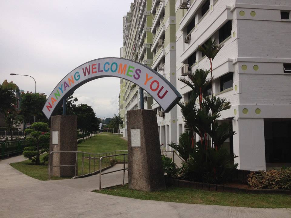
Understanding Jurong West
Jurong West is a residential town in the West Region of Singapore, built up largely by the Housing and Development Board as a mature housing estate. For a visitor, that matters in a practical way: this is a lived-in neighbourhood rather than a tourist district, and it is relatively distant from the city centre. Getting around therefore depends on Singapore's public transport system, which city planners intend to become the preferred way to travel, partly to reduce pollution from heavy road traffic.
The town sits in the western part of Singapore, bordered by the Pan Island Expressway to the north and the Ayer Rajah Expressway to the south, with Sungei Jurong and Jurong Lake to the east. Its town centre is in Jurong West Central. The town is divided into nine subzones: Boon Lay, Chin Bee, Hong Kah, Jurong West Central, Kian Teck, Safti, Taman Jurong, Wenya and Yunnan.
How Visitors Move Around Singapore
Singapore's public transport is designed to be the default way of getting about, and visitors can use the same system as residents. The main options are the MRT (mass rapid transit) rail network, an extensive bus network, and taxis or ride-hailing apps. A single stored-value or contactless card works across the rail and bus networks, so you do not need separate tickets for each mode.
For navigation, real-time information is available through the MyTransport.SG app and Google Maps, both of which are useful for planning routes and checking when the next service is due.
Rail: The MRT Network
Singapore's MRT is the backbone of the network, with several colour-coded lines. For Jurong West, the key line is the East West Line, which connects Changi Airport through the city to the Jurong Lake District in the west. The elevated track infrastructure of the East West Line was built alongside the public housing blocks in the 1980s, so the stations sit right inside the residential fabric of the town.
The nearest MRT station to much of Jurong West is Boon Lay on the East West Line. Jurong East is an interchange where the East West Line meets the North South Line; the North South Line runs from the west through the city centre — including Orchard, City Hall, Raffles Place and Marina Bay — and on to the northeast. The Downtown Line extends to Buona Vista in the west, giving another connection point for journeys into the city.
- Fares: distance-based, with a minimum fare and a higher maximum for the longest cross-city trips.
- Frequency: trains run every few minutes at peak times and slightly less often off-peak.
- Hours: service generally starts around the early morning and runs until around midnight, with some lines running a little later.
- Tapping: you must tap in and tap out. If you fail to tap out, you are charged the maximum fare.
- Rules: eating, drinking and carrying durian are prohibited on the network, and fines apply.
Buses and Other Public Transport
Buses fill in the gaps that the rail network does not reach, including residential areas like Jurong West. The bus network is extensive, and express bus routes operated by SBS Transit and SMRT run along expressways, which can be faster than the MRT for certain journeys.
Jurong West is well served by buses. Boon Lay Bus Interchange and Jurong East Bus Interchange are the main hubs for routes covering the area, and the interchange at Boon Lay is directly connected to Boon Lay MRT station, the Jurong Point shopping mall and The Centris condominium in one contiguous complex — so you can move between bus, rail and shops without going outdoors.
Local bus stops are scattered through the residential streets, including along Corporation Drive, Corporation Road, Yuan Ching Road and International Road, serving landmarks such as Jurong Secondary School, the Japanese Garden, Jurong Futsal Centre and nearby housing blocks. Routes serving the area include services connecting Boon Lay Interchange with Bedok, Jurong East Interchange with Jurong Island Checkpoint, and various loop services around Boon Lay Drive and Jalan Ahmad Ibrahim, as well as routes heading out to Woodlands, Eunos and Jurong Town Hall.
- Fares: distance-based, cheaper than a taxi and comparable to MRT fares.
- Payment: the same methods as the MRT — EZ-Link, SimplyGo contactless bank cards, or a Singapore Tourist Pass.
- Tapping: tap on when boarding and tap off when alighting.
- Navigation: use MyTransport.SG or Google Maps to find the right route and stop.
Taxis and Ride-Hailing
Taxis and ride-hailing apps are the most convenient option for late nights, when carrying luggage, or when heading somewhere the buses and trains do not reach easily. Grab is the dominant ride-hailing app, and all taxis can also be booked through it, with upfront fares shown before you confirm.
Metered taxis from operators such as ComfortDelGro and SMRT Cabs charge a flag-fall fare plus a per-distance rate, with additional surcharges for airport pickups, midnight travel and peak hours. Ride-hailing fares rise during peak hours, on Friday evenings and in heavy rain, so it pays to check the price before committing.
As a rough guide to cost, short trips within the city centre are inexpensive, while a journey from Changi Airport into the city costs considerably more. Note that there is a road entry surcharge for Sentosa. For late nights after the MRT stops running around midnight, Grab or the night bus services are the practical alternatives.
Walkability
Walking in Jurong West is realistic for short hops between housing blocks, bus stops and the town centre, but it is not a town designed for long pedestrian journeys. The main public transport amenities — Boon Lay MRT station, Boon Lay Bus Interchange, Jurong Point and The Centris — are grouped in a single connected complex, which makes transfers on foot easy and comfortable.
Jurong West also has a network of green connectors along its two main rivers, Sungei Jurong and Sungei Lanchar. These park connectors link housing precincts to neighbourhood parks such as Jurong Central Park, the Jurong West Sports Centre, Jurong West Stadium and Frontier Community Centre, and they connect onward to the Chinese Garden in Jurong East and Bukit Batok Town Park in the north. They are pleasant for a stroll or a cycle, but they are recreational routes rather than shortcuts to the city.
Two things to keep in mind: Singapore's midday heat and humidity make walking uncomfortable in the middle of the day, so it is better to walk in the early morning or evening. In the city centre you will find an extensive network of covered walkways linking MRT stations, malls and buildings, but do not expect that level of shelter throughout a residential town like Jurong West. Across Singapore there is also a large Park Connector Network for walking and cycling, linking parks and nature reserves.
Getting from the Airport into the City
Changi Airport is connected to the city by the East West Line, the same line that serves the western part of Singapore. That means a visitor arriving at the airport can ride the MRT into the city centre and, if heading to Jurong West, continue west on the same line towards the Jurong Lake District and Boon Lay — changing at an interchange such as Jurong East if needed.
By taxi or ride-hailing app, the airport-to-city journey is the more expensive but more direct option, and it is the sensible choice if you are arriving late, have heavy luggage, or are travelling in a group. Expect surcharges on airport pickups and higher fares during peak hours or bad weather.
Before you travel, it is worth sorting out payment and connectivity. Tourist SIM cards with unlimited data are available at Changi Airport from Singtel, StarHub and M1, as well as at Mustafa Centre and 7-Eleven stores, and eSIM options exist if you prefer not to swap physical cards. For transport payment, pick up an EZ-Link card, use a SimplyGo contactless bank card, or buy a Singapore Tourist Pass — any of these works on both the MRT and the buses.