Getting Around El Fasher: A Practical Guide
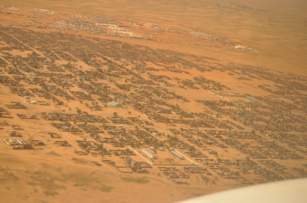
El Fasher is the capital of North Darfur State in western Sudan and a long-established caravan and market town, sitting at roughly 700 metres above sea level. It has a hot, arid climate with a bone-dry cool season, a sweltering hot season, and a short wet season in the middle of the year. Before you plan any movement around the city, you should be aware of the security situation: the city was besieged during the ongoing Sudanese civil war, fell to the Rapid Support Forces in late 2025, and by early 2026 was described as a ghost town. Travel here is not ordinary tourism, and conditions on the ground can change drastically. The guidance below describes the transport options that exist in and around El Fasher in normal circumstances.
How Tourists Move Around the City
Within El Fasher itself, the most convenient ways to get around are taxis and motorised rickshaws. Public transport exists but is often overcrowded and does not run to a strict schedule, so it is less reliable if you are trying to keep to a plan. Fares for taxis and rickshaws should be agreed with the driver in advance, because meters are rarely used. Carry cash in Sudanese pounds, since international bank cards are rarely accepted, and exchange money at official banks or certified exchange bureaus on arrival.
A few practical points will make moving around easier:
- Arabic is the primary language, and English is not widely spoken on the streets, so it helps to have key phrases or a translator arranged in advance.
- Dress modestly with loose, breathable clothing that covers shoulders and knees; a hat and sunglasses are useful, and women are advised to carry a light scarf or shawl.
- Drink bottled water, avoid ice in drinks at street cafés, and carry basic medicines and insect repellent.
- Use the right hand when passing money or food and when eating, and ask permission before photographing residents.
- Alcohol is banned under Islamic law, and you should avoid photographing government buildings, military facilities, bridges, and the airport.
Rail, Metro and Tram
El Fasher has no railway station, and the national rail network does not reach North Darfur. The western railway line terminates at Nyala in South Darfur. There is no metro or tram system in the city. For practical purposes, you should not plan any part of your journey around rail-based transport.
Buses and Other Public Transport
Buses connect El Fasher with regional settlements, making them the main form of long-distance ground public transport. Journeys from the city to other towns in the region are long: the route to Khartoum runs well over a thousand kilometres and takes roughly a day of travel, while trips toward El Geneina and Zalingei are shorter but still substantial. If you are heading in the direction of Zalingei, that route is described as the most comfortable ground option in that direction.
Within the city, public transport is available but crowded and unscheduled. Treat it as a flexible, low-cost option rather than a dependable timetable.
Taxis and Ride-Hailing
Taxis and motorised rickshaws are the most convenient options for getting around El Fasher. There is no mention of ride-hailing apps operating in the city, so you should expect to arrange transport directly with drivers. Always agree the fare before you set off, as meters are rarely used.
Walkability
Walking is possible in the city centre and around the local souq, which is known for dates, spices, and leather and straw handicrafts, and where bargaining is expected. However, the climate works against long walks: the hot season brings afternoon temperatures around 38 °C, and the wet season brings higher humidity. Plan walks for the cooler parts of the day, carry water, and be prepared for dust and heat. Given the security history of the city, walking freely, especially after dark or away from central areas, is not advisable.
Getting from the Airport into the City
El Fasher Airport (IATA: ELF) is located within the city limits, which makes the transfer into town short and straightforward compared with many destinations. The airport primarily handles domestic flights, so international travellers generally need to transfer via Sudan's main international airport in Khartoum onto a domestic flight to El Fasher. Note that some sources contain contradictory information about whether the city has its own airport; the airport code ELF and its location within the city are the reliable details.
Once you arrive, taxis and motorised rickshaws are the practical way to reach your accommodation, and you should agree the fare in advance. Remember that photographing the airport is discouraged.
Arriving by Road
El Fasher is linked by road to both Geneina and Umm Keddada, and longer-distance road travel connects it with Khartoum and other regional towns. Road conditions can vary, with paved highways giving way to unpaved sections, so a 4x4 or other high-clearance vehicle is recommended for the longer routes. If you are travelling by car rather than bus, plan for long days of driving and confirm the current state of the route before setting out.