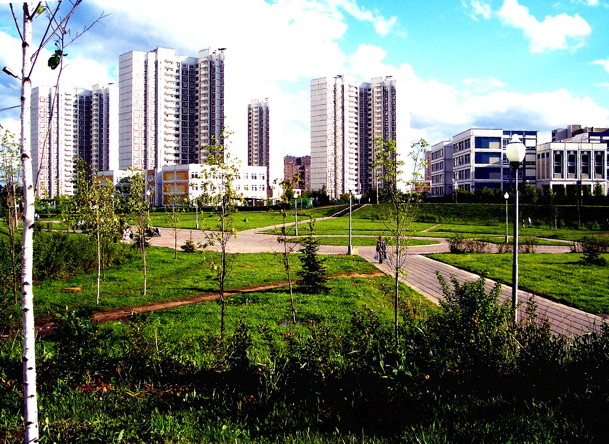
Orientation: a Moscow exclave built for walking
Zelenograd is an administrative okrug of Moscow, but it sits as an exclave inside Moscow Oblast, northwest of the centre along the M10 highway. For a visitor this matters in a practical way: you are inside the Moscow transport system, yet you are in a planned, self-contained city rather than a dense central district.
Zelenograd was founded as a new town and laid out to a single general plan, with influences from the garden city movement and from new-town design in Finland and the United Kingdom. The result is a place of microdistricts, green space and wide streets rather than a tangled historic core. That layout shapes how you get around: the city is legible, and much of it is pleasant on foot, but its parts are spread out enough that you will want public transport or a car for longer hops.
How the city is laid out
Zelenogradsky Administrative Okrug is divided into five districts: Matushkino, Savyolki, Staroye Kryukovo, Silino and Kryukovo. The first four sit together and are unofficially known as the Old City; Kryukovo District lies on the other side of the Saint Petersburg – Moscow Railway and is unofficially called the New City.
One quirk is worth knowing before you try to find an address. Most postal addresses in the city have no street or square name at all. Buildings are identified by a three- or four-digit number, where the first one or two digits give the microdistrict and the last two give the building within it. There is no 13th microdistrict. If someone gives you an address as a bare number, that is normal here, not a mistake.
Rail and metro
Zelenograd's rail connection is the historic anchor of the place: the city was founded as a planned town near the village and railway station of Kryukovo, on the Saint Petersburg – Moscow Railway. That line still divides the Old City from the New City, and it is the seam along which the Kryukovo district sits.
Because Zelenograd is an administrative okrug of Moscow, it is tied into the Moscow transport network rather than standing alone as a separate regional town. Practically, this means the rail line toward Moscow is your main artery in and out, and onward metro connections are made in Moscow itself rather than inside Zelenograd.
Trams and buses
Within the city, surface public transport is the workhorse. The local network is operated by ГУП Мосгортранс (Mosgortrans), the Moscow city operator, which runs both bus and tram services here.
Bus routes thread through the main corridors, and the stops cluster along the city's principal roads. The key streets with public transport stops include:
- Панфиловский проспект (Panfilovsky Prospekt) — the primary road through the city, and the main spine for surface routes
- улица Каменка (Ulitsa Kamenka) — a secondary road with a dense run of stops
- Солнечная аллея (Solnechnaya Alleya) — a primary road carrying several stops
- Георгиевский проспект (Georgiyevsky Prospekt) — another primary road with stops
- Крюковская площадь (Kryukovskaya Ploshchad) — a residential street with a cluster of stops
If you learn one thing about the network, learn Panfilovsky Prospekt: it is the road most routes and most useful stops are organised around.
Tickets and passes
Since the buses and trams are run by the Moscow city operator, you are dealing with the Moscow fare system rather than a separate local one. The practical upshot for a visitor is that you should expect to use the same ticketing habits you would use elsewhere in Moscow — buying and topping up a reusable transport card, or paying a single fare per ride — rather than hunting for a Zelenograd-specific ticket. Check current fares and card rules when you arrive, as these change.
Taxis and ride-hailing
Taxis and app-based ride-hailing are a sensible fallback here, particularly for the last leg to an address that is only a microdistrict-and-building number, or for crossing between the Old City and the New City when you do not want to wait. Because the city is compact and its road layout is straightforward, a car journey across Zelenograd is short and easy to describe to a driver — give the microdistrict and building number and you will be understood.
Walking
Walking is genuinely rewarding in Zelenograd. The city was planned with a strong garden-city influence, and greenery makes up a substantial share of its area — it has long ranked among the greenest of Moscow's administrative okrugs. The Skhodnya River originates nearby and forms two ponds within the city, the Small and Large City Ponds, which give the centre a pleasant waterside edge.
The microdistrict layout also means that everyday needs — shops, stops, services — tend to be grouped locally rather than strung along one long high street. The trade-off is scale: the districts are spread across the okrug, and the railway separates the Old City from the New City, so while individual neighbourhoods walk well, you should not plan to walk the whole city end to end.
Arriving from the airport
Zelenograd has no airport of its own; the source material does not identify one. Visitors therefore arrive through Moscow's airports and continue onward. The reliable route is by rail: take the train from Moscow toward Kryukovo, the station around which Zelenograd was originally built, and you arrive directly in the city. From central Moscow, the M10 highway is the road link northwest to Zelenograd, which is the route a taxi or ride-hailing car will take.
Whichever airport you land at, plan your onward leg as: airport into Moscow's rail or road network, then the train or the M10 corridor out to Zelenograd. Confirm current timetables and connections on arrival, since services and airport links change.
Practical summary
- Use the rail line to and from Moscow — it is the city's founding connection and its main artery.
- Get around locally by bus and tram, run by the Moscow operator Mosgortrans, using Moscow-style ticketing.
- Orient yourself on Panfilovsky Prospekt, the main road and the hub of surface routes.
- Expect addresses as bare microdistrict-and-building numbers, with no street name.
- Walk within neighbourhoods, but use transport to cross between the Old City and the New City.
- Fall back on taxis or ride-hailing for short cross-city hops and awkward addresses.
- Reach the city from the airport via Moscow's rail network to Kryukovo, or by road along the M10.