Getting Around Sterlitamak
Sterlitamak is the second-largest city in Bashkortostan and lies on the left bank of the Belaya River, south of the republic's geographic center. It has a developed transport system, and for a visitor the practical picture is simple: the city is served by trolleybuses and buses, taxis are easy to arrange, and the historic core is compact enough to explore on foot. Rail links and the local airport sit at the edges of the picture rather than in the middle of a city break.
Orientation Before You Move
Knowing the city's layout helps you choose the right mode of transport. The original town grew between the Ashkadar and Sterlya Rivers; this area is now the historical center, known as the "Old Town." Later development spread mainly to the west and north. The Sterlya flows through the central part of the city and is crossed by one rail bridge and several road bridges, with another under construction. In the southeast, the Ashkadar separates the Zaashkadarye Microdistrict from the main part of the city, and the Belaya River forms the eastern boundary. If you are staying in the Old Town, most day-to-day wandering stays on foot; if you are heading to the newer western or northern districts, plan on public transport or a taxi.
Trams, Metro and Rail
Sterlitamak has no metro and no tram network, so do not expect either. The city does have a railway connection: it is linked by rail to Ufa and Orenburg. The railway was originally laid mainly for freight, with the first freight train arriving in the 1930s, so the rail connection is best treated as a way of reaching the city from elsewhere in the region rather than as a way of getting around inside it. For local trips, rely on the road-based options below.
Trolleybuses and Buses
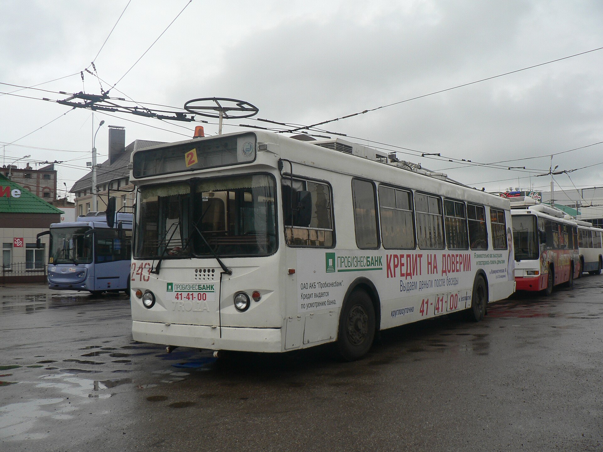
The trolleybus is the city's signature form of public transport: the first trolleybus line in the Bashkir ASSR opened in Sterlitamak in 1961, and trolleybus service has continued since. Together with buses, this is how you will move between districts if you are not walking or taking a taxi. The network is described in general terms as a developed transport system rather than a dense grid, so the practical approach is to identify the route serving your destination before you set out. Tickets are bought on board in the usual Russian way, from the driver or conductor, and paying in cash for a single ride is the simplest option for a visitor.
Taxis and Ride-Hailing
Taxis are a straightforward fallback, particularly for trips across the rivers to the newer districts or for late-evening journeys. Ride-hailing apps work in Russian cities of this size, and a taxi is also the sensible choice when you are carrying luggage or arriving at an awkward hour. Agree the fare or confirm the app price before you set off, as you would anywhere in Russia.
Walking
The Old Town, built between the Ashkadar and Sterlya, is the most rewarding part of the city to explore on foot, and the central section along the Sterlya is walkable via its road bridges. Elsewhere, the city is spread out and divided by rivers, which makes long walks between districts less practical. A good pattern is to walk within the historic center and take a trolleybus, bus or taxi for anything farther afield. Note that Sterlitamak was long associated with heavy industry and was once listed among the country's most polluted cities; extensive greening programs followed, and the city has since been recognized for its comfort and landscaping, so parks and tree-lined streets are pleasant places to stroll.
Arriving by Air
Sterlitamak has a small local airport, located some distance outside the city. Many visitors instead arrive via Ufa, the republic's capital, which is the larger transport hub and is connected to Sterlitamak by rail and road. If you land in Ufa, you can continue to Sterlitamak by train or by road.
Practical Tips
- Plan around trolleybuses and buses for cross-city trips; there is no tram or metro to fall back on.
- Pay for public transport on board; carry some cash for single rides.
- Use taxis or ride-hailing for luggage, late nights and trips to the outer districts.
- Keep your walking to the Old Town and central riverside, where the street layout is compact.
- Treat the railway as your link to Ufa and Orenburg, not as local transport.
- Arrange airport pickup in advance, since no public airport service is described.