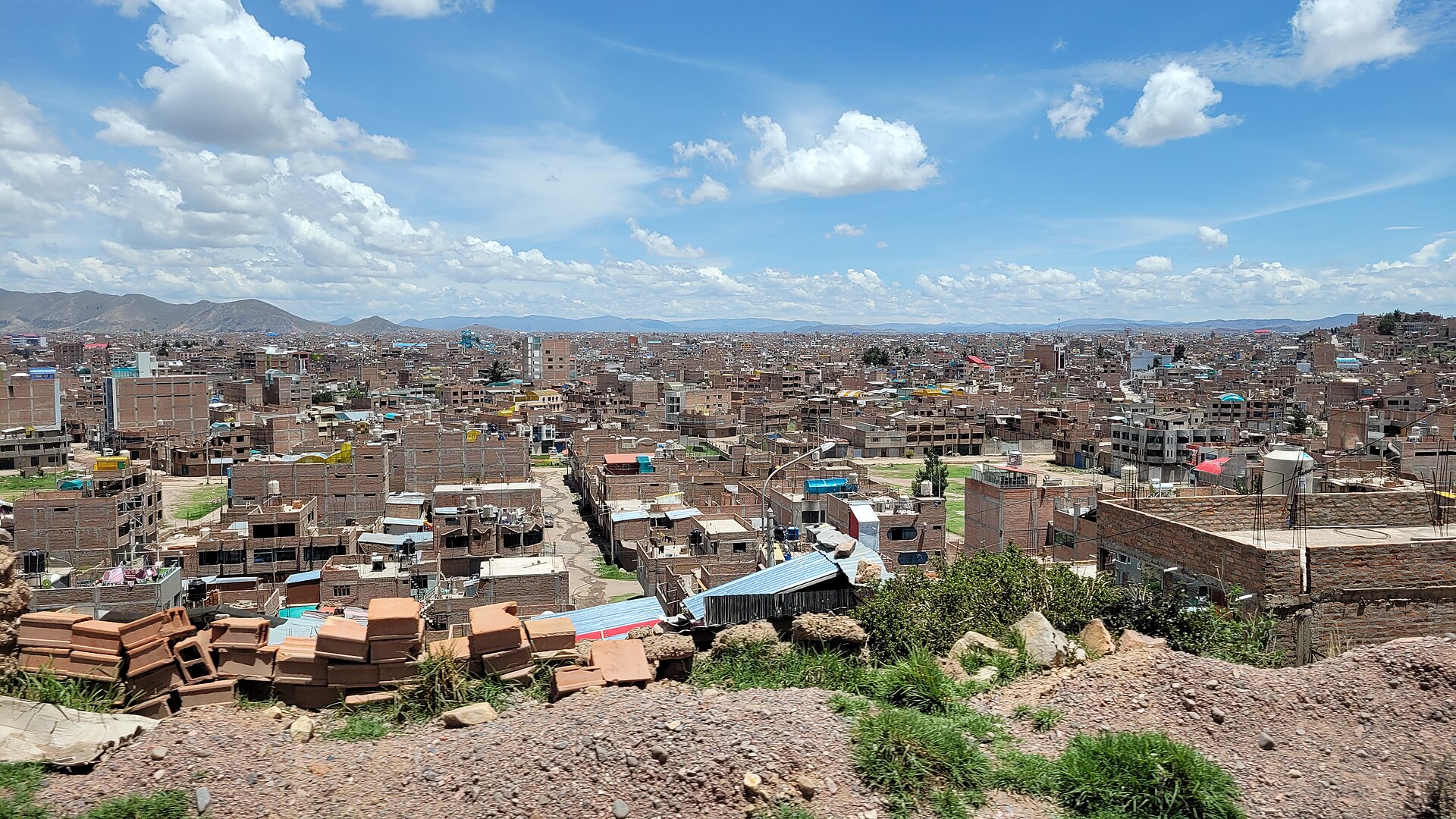
Orientation
Juliaca sits high on the Collao Plateau in southeastern Peru, at over 3,800 metres above sea level, and serves as the largest trade centre in the Puno region and a major transit hub for southern Peru. It is nicknamed "The Windy City" for its exposed position on the plateau, so expect cold temperatures, especially at night, and strong daytime sun. The city is a practical base for reaching Lake Titicaca, Puno, and the surrounding Altiplano, and its layout is fairly compact around the centre, with the Plaza de Armas as a useful reference point.
How Tourists Get Around
Getting around Juliaca is informal and inexpensive. The most popular and affordable ways to move around the city are auto-rickshaws (moto-taxis) and cycle rickshaws (cholo-taxis). These are the workhorses of local transport and are easy to flag down on the street.
- Moto-taxis and cholo-taxis: The most common and cheapest options for short trips around town.
- No meters: Fares are not metered, so agree on the price with the driver before boarding.
- Cash: Bring small notes and coins; cash is needed almost everywhere, especially for transport and markets.
Rail Network
Juliaca is a railway junction in southern Peru, served by PeruRail. The line connects Cusco with Puno on the shore of Lake Titicaca, and the Titicaca train stops in Juliaca, offering panoramic carriages and a high level of service. Passenger traffic at Estación Juliaca is minor, so the train is more of a scenic and regional connection than a day-to-day commuter option.
One local curiosity worth knowing: the tracks run through city streets and the market area, and vendors clear their goods from the rails before the train passes. If you are near the line, stay alert and keep clear of the tracks.
Buses and Public Transport
Juliaca's main bus terminal, the Terminal Terrestre, is about a 20-minute walk east of the Plaza de Armas, or a much faster taxi ride. Daily buses connect the city with major regional destinations, including Cusco, Arequipa, Puno, Copacabana, and Lima. Operators serving these routes include Cruz del Sur, Civa/ExcluCiva, and Transzela.
- Regional connections: Buses run to and from Cusco, Arequipa, Puno, Copacabana, and Lima.
- Buying tickets: Purchase at the Terminal Terrestre or through the operators directly; it is wise to confirm departure times in person or by phone ahead of travel.
- Within the city: There is no metro or tram network; local movement relies on moto-taxis, cholo-taxis, and buses rather than rail-based transit.
Taxis and Ride-Hailing
Taxis and moto-taxis are readily available and are a practical way to cover longer hops across town or to reach the bus terminal with luggage. As with moto-taxis, there are no meters, so agree on the fare before you set off. Ride-hailing apps are not part of the local transport picture described here, so plan on hailing vehicles on the street or arranging them through your accommodation.
- Agree the price first: Confirm the fare before boarding any taxi or moto-taxi.
- Safety: Watch your belongings in crowded places, especially markets, avoid displaying expensive gadgets, and avoid walking alone in remote areas after dark where lighting is poor.
- Greetings: It is customary to greet the driver when you get in ("Buenos días" or "Buenas tardes").
Walkability
The centre of Juliaca is walkable, with the Plaza de Armas, the Santa Catalina church, and the Plaza Bolognesi area within easy reach of one another on foot. The Terminal Terrestre is roughly a 20-minute walk from the Plaza de Armas, though a taxi is a much faster and easier option with bags. Walking is a good way to explore the markets and central streets, but be mindful of the altitude, the cold, and the strong sun.
- Altitude: At over 3,800 metres, take it slowly at first; altitude sickness ("soroche") is possible, so drink water, avoid heavy food initially, and try coca-leaf tea.
- Sun and cold: Bring a warm jacket, thermal layers, comfortable footwear, sunscreen, and a head covering.
- Water: Do not drink tap water; buy bottled water.
- Markets: Juliaca is known for alpaca wool products, sweaters, and blankets at some of the lowest prices in the region, often cheaper than Cusco.
Getting from the Airport into the City
Inca Manco Cápac International Airport (JUL) sits in the northwest part of town, along Av Ferrocarril and Av Aviacion, very close to the city limits and a short transfer from the centre. It is the nearest airport to the western shores of Lake Titicaca, serving travellers heading to Capachica and Puno. Airlines operating here include LATAM Peru and Sky Airlines Perú, both with flights from Lima.
- Transfer options: Because the terminal is so close to the city, the onward trip into the centre is short; taxis and moto-taxis are the practical choices.
- Agree the fare: As elsewhere in Juliaca, settle the price with the driver before you set off.
- Alternative airports: Arequipa and La Paz, Bolivia, are other airports in the wider region if your plans take you further afield.
Practical Tips
- Currency: The Nuevo Sol (PEN). Cash is needed everywhere, especially markets and transport; cards are accepted at major supermarkets and hotels. Use official casas de cambio rather than street money changers.
- Language: Spanish is the main language, with many locals also speaking Quechua or Aymara. English is practically not spoken, so an offline translator or basic Spanish is useful.
- Etiquette: Greet people when entering shops or taxis, and ask permission before photographing locals, especially women in traditional attire.
- Timing: The city hosts Carnaval Juliaca each year between February and March, a very popular event when participants in colourful costumes dance in the streets in the style of the Collao Plateau. Saint Sebastian's feast is celebrated on 20 January.