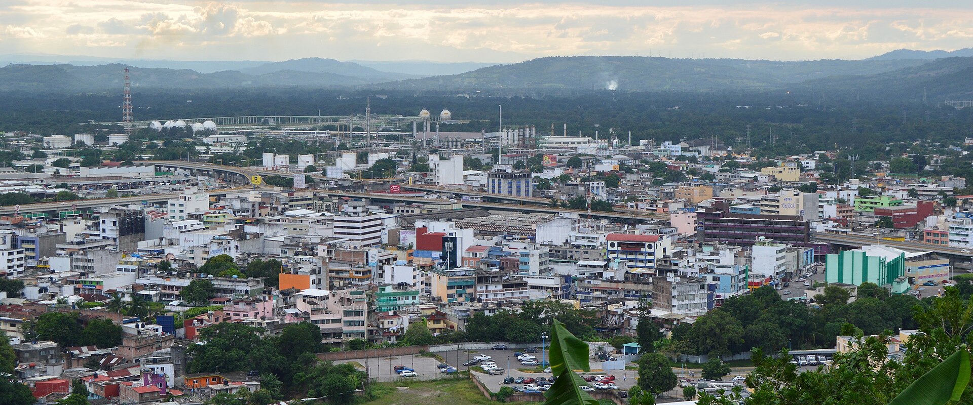
Getting Around Poza Rica de Hidalgo
Poza Rica is a modern, oil-built city in northern Veracruz, laid out on a small valley with well-lined, contemporary streets rather than a colonial core. That layout, plus its role as a regional hub for road transport, shapes how visitors move around: there is no rail or metro system to rely on, so getting around means buses, shared taxis, regular taxis, and walking.
Rail, Metro and Tram
Poza Rica has no metro, tram, or passenger rail network. The city's public transport is entirely road-based, so plan your movements around buses, taxis, and your own two feet.
Buses and Public Transport
Public transport is the main way locals get around, and it consists of buses that run to different areas of the city, along with shared taxis. For visitors, this means you can reach most parts of Poza Rica by bus, but you will generally need to know which route serves your destination rather than relying on a numbered system.
Poza Rica is also a major hub for longer-distance road travel, which matters if you are arriving from or continuing to another city:
- Central de Autobuses (main terminal): the city's principal bus station, served by more than 30 lines from across the country, including Estrella Blanca, ADO, Axis Gulf, First Plus, Chihuahuan, AU, Platinum ADO, ADO GL, Premium Green, Futura, and Omnibus de Mexico. It sits in northwest Poza Rica near Federal Highway MEX-180, with a spacious modern waiting area, restrooms, and food services.
- ADO terminal: a second terminal with access only to passengers travelling to the neighbouring city of Tuxpan.
- Petromex terminal: a third terminal, in the Petromex area, serving routes heading south of the country, such as Xalapa, Veracruz, Coatzacoalcos, Villahermosa, Ciudad del Carmen, and Chiapas.
Because the terminals serve different destinations, check which one your route departs from before you set out. Tickets are bought at the terminal from the individual bus lines.
Taxis and Ride-Hailing
Taxis are plentiful and are the most common way for travellers to get around the city. Poza Rica's taxis are typically Tsuru models. Shared taxis, known locally as peseros or colectivos, run fixed routes throughout the city and to neighbouring towns, and are what locals use most often.
Uber also operates in Poza Rica and can be a safe, reliable way to get around without having to carry cash.
Walking
Poza Rica is a relatively new city, founded officially in 1951, and unlike most Mexican cities it has no old buildings; instead it has contemporary architecture with well-lined, designed streets and a modern look. That makes the central areas reasonably straightforward to navigate on foot.
Useful landmarks for orienting yourself include:
- Poza Rica Center – the commercial centre of the city.
- Parque Plaza March 18 – the city's central park, between Avenues Lázaro Cárdenas and Calle 8 Norte, with an auditorium for musical events.
- Juárez Park – the second-largest park, on 16th Avenue West.
Note that much of the land sits on uneven ground, with hills mostly to the northeast of the city, so some areas are steeper than the centre.
Getting from the Airport into the City
El Tajín National Airport (PAZ) in Tihuatlán serves Poza Rica. It has a single runway and a small commercial passenger terminal, but as of 2024 it has no scheduled commercial service; it is used for business jets and private aircraft.
Because there are no scheduled flights, there is no regular airport-to-city transfer service to plan around. If you are arriving by private or business aircraft, arrange your onward transport in advance, and expect to reach the city by road, as Poza Rica's transport options are entirely road-based.
Practical Tips
- Carry small change or use Uber if you would rather not handle cash for taxis.
- For intercity travel, confirm whether your bus leaves from the Central de Autobuses, the ADO terminal, or the Petromex terminal.
- The city is a central hub for several road transportation lines and draws daily visitors from nearby towns and municipalities, so terminals and buses can be busy.
- Poza Rica stands on Federal Highway 180, which is the main road reference point for the city and its bus station.