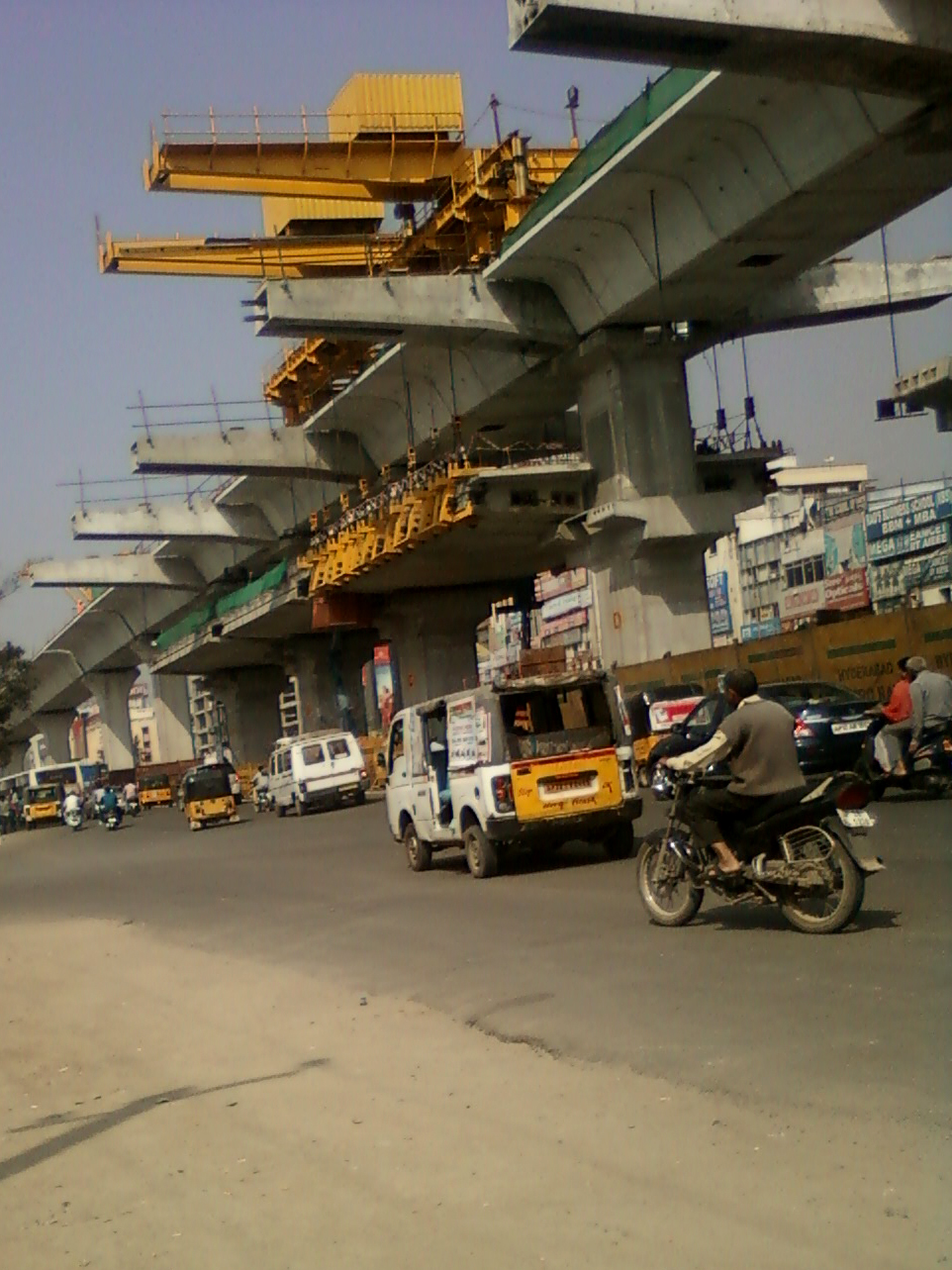
Orientation: Where Kukatpally Sits
Kukatpally is a suburb in the north-western part of Hyderabad, in the Indian state of Telangana. It is the headquarters of the north zone of the Greater Hyderabad Municipal Corporation, and it sits close to the HITEC City information-technology hub, to which it is connected by road. For a visitor, the practical upshot is that Kukatpally works well as a base: it has its own commercial centre of restaurants, clothing retailers and small offices, and it is plugged into Hyderabad's wider transport network by road, rail and metro.
Telugu is the predominant language spoken here, and the suburb is dense and busy, so allow extra time for movement during the morning and evening rush.
How Visitors Get Around
Getting around Kukatpally and the rest of Hyderabad relies on a handful of modes that overlap and feed into one another: the metro, the suburban rail network known as MMTS, city buses run by TSRTC, auto-rickshaws, and app-based taxis. Most journeys combine at least two of these, and the metro stations and bus depot act as the natural interchange points.
- Metro — the fastest way to cover longer distances across the city.
- MMTS suburban rail — useful for reaching specific rail-connected pockets.
- TSRTC buses — the widest-reaching option, with connections to almost all parts of Hyderabad.
- Auto-rickshaws and app-based cabs — the usual choice for short, last-mile trips.
Metro and Rail
Kukatpally is served by three metro stations: Kukatpally, KPHB and Balanagar (Moosapet). These sit on the Hyderabad Metro's Red Line, and the KPHB Colony and JNTU stations are also close by. The Kukatpally bus depot functions as a feeder link to the Red Line, so you can switch between bus and metro fairly easily.
For suburban rail, the nearest railway station to Kukatpally is in Lingampally. The area can also be reached via MMTS stations at HITEC City and Bharat Nagar. If your destination is one of those rail-connected areas, MMTS is worth checking alongside the metro.
Buses and Other Public Transport
TSRTC operates the buses in Kukatpally and maintains a depot at the Kukatpally Y Junction, near NH-65 (the Mumbai Highway) and the Outer Ring Road. This depot is a major operational centre for north-west Hyderabad and the IT corridor, and it doubles as a terminus with passenger boarding areas, waiting seating, ticket counters and route information boards. Drinking water, washrooms and nearby food stalls are available, and there is an auto-rickshaw and shared-auto stand close by.
Services run from early morning until around late evening, with some late-night services, especially toward Secunderabad, Koti and the airport. Buses are frequent but crowded during the morning and evening peak hours, and the IT corridor routes in particular can be overcrowded. If your schedule is flexible, the quieter windows are after 11 AM and between roughly 2 and 4 PM.
Route numbers are the simplest way to navigate. Examples of TSRTC services from Kukatpally include:
- 5K — Kukatpally to Koti
- 10K — Kukatpally to Secunderabad
- 113M — Kukatpally to Mehdipatnam
- 220 — Kukatpally to HITEC City
- 225 — Kukatpally to BHEL
- 229 — Kukatpally to Miyapur
- 290U — Kukatpally to Uppal
Several classes of service are available. Metro Deluxe and Metro Express run to major city hubs; air-conditioned buses serve HITEC City, Gachibowli and the Financial District; express buses are added during peak office hours; and feeder services connect to the KPHB Colony and JNTU metro stations. Electric buses are being increasingly deployed. Inter-city services also run from here to places such as Sangareddy and Patancheru, and to towns along the Mumbai and Bangalore highways.
Tickets are bought at the depot's ticket counters or on board, and route information boards at the depot help you find the right service. Note that real-time digital display boards are still limited, so it pays to confirm timings with staff or fellow passengers.
Taxis and Ride-Hailing
App-based cabs and auto-rickshaws are the standard options for last-mile connectivity around Kukatpally, filling the gaps between metro stations, the bus depot and your final destination. Auto-rickshaws and shared autos are readily available near the depot. For airport runs, the TSRTC Pushpak airport liner service is a bus-based alternative to a cab.
Walkability
Kukatpally is a dense, commercially active suburb, and its main roads — Kukatpally Main Road along the Mumbai Highway (NH-65), Nizampet–Miyapur Road, Gajularamaram Road and Moosapet Road — carry most of the public transport stops. That makes short walks between stops and nearby shops, eateries and malls feasible. That said, this is a busy traffic environment: NH-65 and KPHB Main Road get congested at peak hours, and monsoon waterlogging can cause delays. Treat walking as a way to cover short local hops rather than a way to cross the suburb.
Getting In from the Airport
The nearest airport is Rajiv Gandhi International Airport in Shamshabad, south of the city. Two practical options connect it to Kukatpally:
- Pushpak airport liner buses — TSRTC runs these services from the Kukatpally bus depot to the airport, making the depot a convenient arrival and departure point.
- App-based cabs — available for a direct door-to-door transfer, and the usual choice if you are carrying luggage or arriving late.
Some late-night bus services also run toward the airport, but schedules vary by route, so confirm before relying on them.
Practical Tips
- Use the metro for longer cross-city trips and buses for the widest coverage; the Kukatpally depot and the Red Line stations are your main interchange points.
- Plan around the peaks: mornings and evenings are frequent but crowded, while mid-morning and mid-afternoon are calmer.
- Keep small change or a payment method ready for bus tickets, and buy at the depot counters where available.
- Expect congestion on NH-65 and KPHB Main Road at rush hour, and allow buffer time during the monsoon.
- For the airport, decide between the Pushpak bus from the depot and an app-based cab based on your luggage and arrival time.