Getting Around Ambattur
Ambattur is a northwestern part of Chennai, and it is served by its own stop on the Chennai Suburban Railway. In practice, visitors treat Ambattur as part of the wider Chennai metropolitan area: the transport options that matter are the suburban trains, the metro, the city buses, taxis and ride-hailing apps, and your own two feet for short hops. This guide describes which modes exist, how they connect, and how to pay for them.
How Visitors Move Around
Chennai's public transport is a mix of suburban rail, metro and buses, each best suited to different kinds of trips. The suburban railway is the workhorse for longer distances within the metropolitan area and for reaching the suburbs, while the metro covers a set of dedicated corridors across the city and is the most accessible option for travellers with mobility challenges. Buses fill in almost everywhere else. Ride-hailing apps and taxis cover the door-to-door trips that public transport does not handle well.
- Suburban rail — best for longer journeys across the metro area and out to the suburbs; Ambattur has its own station.
- Metro — fast, frequent and relatively accessible, but limited to its own corridors.
- Buses — the cheapest way to get almost anywhere in the city, though routes are complex.
- Taxis and ride-hailing — the practical choice for direct, door-to-door trips.
Rail, Metro and Tram Network
The Chennai Suburban Railway connects the city with its suburbs, and Ambattur is served by Ambattur railway station. It is a useful mode for covering longer distances within the metropolitan area. Paper tickets are purchased at the stations. Be prepared for trains to be very crowded at peak times.
The Chennai Metro (CMRL) runs two lines: the Blue Line, between Wimco Nagar and the Airport, and the Green Line, between Central Metro and St. Thomas Mount. For single journeys you buy a token; if you plan to ride frequently, a chip card is available and comes with discounts. Fares are modest. Services generally start in the early morning and run until late evening, with trains every few minutes at peak times. Most stations have elevators and ramps, making the metro the most wheelchair-accessible of the public transport options.
There is no tram network to use for getting around.
Buses and Other Public Transport
MTC buses are the cheapest way to travel and reach nearly every part of the city. You pay the conductor in cash, so it helps to carry exact change. The route network is complex, and even locals often rely on mapping apps to work out which route and stop they need. Buses run from early morning until late at night, and they get crowded during peak hours.
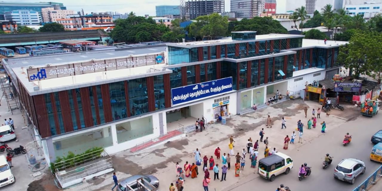
The Ambattur Industrial Estate has its own bus terminus, which makes the industrial area reachable by bus. For visitors who want an organised overview rather than a point-to-point trip, the Tamil Nadu Tourism Development Corporation (TTDC) runs guided city tours, and some private operators offer full-day city excursions. Note that there is no boat taxi or water transport for getting around the city, and no cable cars or funiculars.
Taxis and Ride-Hailing
Ola and Uber are the most common way to hail a taxi. Both are app-based, with fares that vary by distance and demand, and you can pay in cash or through the app. GPS tracking means you can follow your route as you go.
Auto-rickshaws can be hailed on the street, but you will need to negotiate the fare. If you would rather avoid bargaining, Ola Auto and Uber Auto offer predetermined fares through the same apps. Auto-rickshaws are open-sided vehicles, so keep your valuables secure while riding.
If you want a car at your disposal, rental services such as Zoomcar and Revv operate in the city. Self-driving is not recommended given the traffic, and renting a car requires an International Driving Permit alongside your national licence. Motorcycles and scooters can also be rented with a valid licence and IDP, and helmets are mandatory — but riding is high-risk for anyone without local experience. Bicycle sharing exists on a limited basis, but the city is not bicycle-friendly, with heavy traffic and few dedicated lanes.
Walkability
Walking works best in specific pockets of Chennai rather than as a way to cross the city. Mylapore, with its temples, heritage lanes and markets, is pleasant on foot, as is the Marina Beach walkway in the evening, the Besant Nagar and Elliot's Beach area, and the Fort St. George area. Guided heritage and food walking tours are available if you want structure.
Outside those areas, expect heavy traffic, uneven sidewalks and few crossings. Avoid walking or cycling on major arterial roads such as Anna Salai during peak hours, and treat cycling as a leisure activity rather than your main way of getting around.
Accessibility
Buses and the suburban railway are largely inaccessible for travellers with mobility challenges. The metro is relatively accessible. Upscale hotels often have accessible rooms, and a private car with a driver is frequently the most practical option for getting around comfortably. Accessible restrooms are limited outside major hotels and malls, sidewalks in older areas are narrow or missing, and cultural sites may have steps or uneven paths.
Getting from the Airport into the City
Chennai's airport sits on the metro's Blue Line, which runs between Wimco Nagar and the Airport — so the metro is a direct rail option for reaching the city from the airport. Buy a token for a single journey, or a chip card if you will be riding frequently; trains run from early morning until late evening and are frequent at peak times.
Beyond the metro, the same options that serve the rest of the city apply: app-based taxis through Ola and Uber for a direct, door-to-door ride, or MTC buses for the cheapest journey. If you are heading to Ambattur specifically, remember that it has its own suburban railway station, so the suburban network is another way to connect the airport end of your journey with the suburb.
Practical Tips
- Peak hours in the morning and evening are very crowded on public transport — plan around them where you can.
- Download offline maps before you travel, and use mapping apps to plan bus routes and stops.
- English is widely understood, especially in tourist areas; a few basic Tamil phrases are helpful.
- Carry small change for bus fares.
- Hiring a private car with a driver is comfortable, air-conditioned and door-to-door, though more expensive; book through reputable hotels or tour operators, and confirm the driver's English proficiency if you need it.