Getting Around Kumbo: An Overview
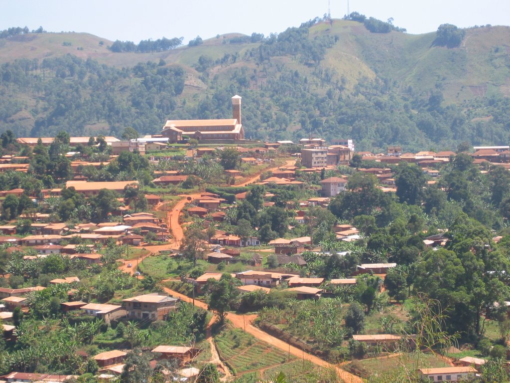
Kumbo is the second-largest city in the North West Province of Cameroon and the capital of Bui Division, sitting at roughly 2,000 metres above sea level on the Bamenda Highlands Ring Road. The town is split into three distinctive hilly settlements — Tobin, Mbveh, and Squares — and this hilly, spread-out layout shapes how you move around. The city is the capital of the Nso Kingdom, and Lamnso is the lingua franca, though Pidgin, English, Oku, Djottin, Fulfulde, French and Hausa are also spoken, which makes getting directions and negotiating transport relatively easy for an English-speaking visitor.
Rail, Metro and Tram
Kumbo has no rail, metro or tram network. There is no train station and no urban rail service of any kind in the city, so these modes play no part in getting around. Plan your movements around road-based transport instead.
Buses and Other Public Transport
Kumbo sits on the Bamenda Highlands Ring Road, roughly 110 km from Bamenda, the provincial capital, and road transport is the practical way in and out of the city. There is no detailed published information on scheduled urban bus services within Kumbo itself, so the realistic approach for a visitor is to use the shared road transport that links the town with Bamenda and the surrounding area, and to arrange local trips as they come up rather than relying on a fixed city bus timetable.
Taxis and Ride-Hailing
You should therefore treat taxis as something to arrange locally — ask at your accommodation, at the hospitals (Shisong Hospital and Banso Baptist Hospital), or around the Mbve market — rather than something you can book in advance through an app. Because the city is divided into three hilly settlements, expect any local trip to involve climbing or descending between neighbourhoods.
Walking
Kumbo's three settlements — Tobin, Mbveh, and Squares — are hilly, and the town's landmarks are spread across them. The Cathedral sits at the top of the square hill, dominating the town's landscape, which gives you a sense of the gradients involved. Walking is a genuine way to cover ground between nearby points, but the hills mean you should allow more time and effort than the map distance suggests. The Mbve market, the main market in Kumbo selling products from the region, Cameroon, Nigeria and other parts of Africa, is a natural orientation point in the Mbve settlement.
Getting from the Airport into the City
The city's documented transport link is the road connection along the Bamenda Highlands Ring Road, roughly 110 km from Bamenda. In practice, this means you should plan your arrival around reaching Kumbo by road, and confirm your onward connection to Kumbo with your carrier or accommodation rather than assuming a direct airport transfer exists.
Practical Tips for Visitors
- Orient yourself around the three settlements — Tobin, Mbveh, and Squares — and confirm which one your destination is in before setting out, since the town is hilly and spread out.
- Use the Mbve market as a central reference point; it is the main market in Kumbo and stocks goods from the region, Cameroon, Nigeria and other parts of Africa.
- Expect to arrange local transport on the ground rather than through an app, since no taxi or ride-hailing network is documented for the city.
- Allow extra time for walking, given the hills and the Cathedral's position at the top of the square hill.
- English and Pidgin are among the languages spoken in Kumbo, alongside Lamnso, Oku, Djottin, Fulfulde, French and Hausa, so you can generally ask for directions and negotiate transport in English.
- Be aware that Kumbo has been affected by the ongoing Anglophone Crisis, including military operations and insurgent attacks in recent years. Check current travel advice and local conditions before you travel and while you are in the area.