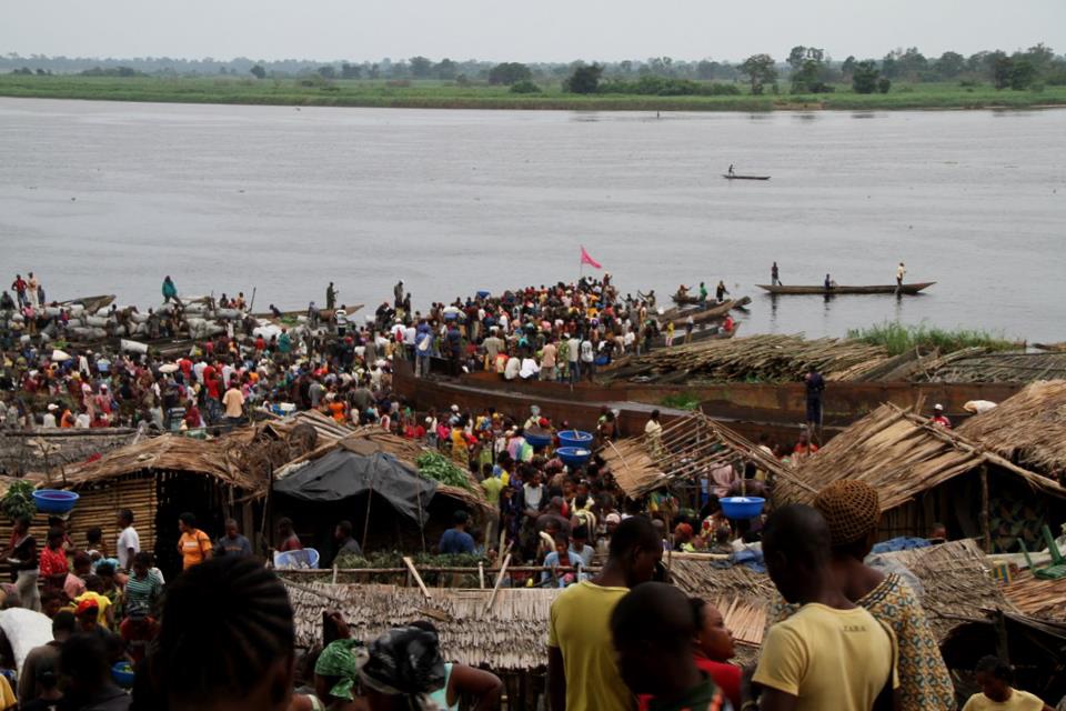
Getting Around Mbandaka
Mbandaka sits on the east bank of the Congo River below the mouth of the Ruki, right beside the equator. It is the capital of Équateur Province, and its infrastructure has suffered from years of war and neglect: large areas of the city have no electricity or running water, and most streets and avenues are unpaved dirt roads. That shapes everything about how you move around. Plan for slow, ground-level travel, and treat the city as a place to explore on foot and by road rather than by any formal transit network.
Rail, Metro and Trams
There is no rail, metro or tram network to use in Mbandaka. The city has no functioning urban train service, and the historic plans for a train station here were part of early proposals to make the town the capital of the Congo Free State — plans that never came off the drawing board. The only rail-related relic in the wider story of the city is the abandoned bridge project over the Congo River begun in 1938, of which only the foundations of the bridge pillars remain. For a visitor, this means there is no ticket to buy, no line to learn, and no station to find: rail simply is not an option for getting around.
Buses and Public Transport
Mbandaka has no organised public transport system that a visitor can rely on. There is no metro, tram or scheduled city bus network described for the city, and the deterioration of infrastructure — unpaved roads across most of the city — makes formal transit impractical. In practice, you should not expect to find bus stops, timetables, or transit passes. Arrange your movements through your hotel, a local contact, or a hired vehicle instead of counting on public transport.
Taxis and Ride-Hailing
There is no ride-hailing or app-based taxi service documented for Mbandaka, and no formal taxi system is described. Given the state of the roads and the lack of organised transport, the realistic options are private arrangements: a vehicle hired through your accommodation, a driver arranged by a local host, or a shared ride negotiated directly. Agree on your destination and fare before you set off, and expect journeys on dirt roads to be slow.
Walking
Walking is the most dependable way to get around the parts of Mbandaka you are likely to visit, but it comes with caveats. Most streets and avenues are unpaved dirt roads, and large areas of the city lack electricity and running water, so plan your walks for daylight and keep to routes you know or that a local contact has recommended. The city's landmarks are spread out: the town hall stands about 4 km north of the equator, the Equator Stone placed by Henry Morton Stanley near the riverbank lies south of the city, and the Eala Botanical Garden and the Bamanya mission research centre are both some distance east of the centre. Those outlying sights are better reached by vehicle than on foot.
Getting from the Airport into the City
Mbandaka is served by Mbandaka Airport, and the city is also reachable by river. Kinshasa is an hour's plane ride away, and boat travel links Mbandaka to Kinshasa and Boende — though the river barge journey to Kinshasa or Boende takes four to seven days. For arrivals by air, there is no documented public transit link, shuttle, or rail connection from the airport into town, so arrange a pickup in advance through your hotel or a local contact, or negotiate a private vehicle on arrival. Because the roads are largely unpaved, allow generous time for the transfer and avoid arriving after dark if you can.
Practical Notes for Visitors
- Languages spoken in the city are Lingala, French and Mongo; French will serve you in most visitor situations.
- The city has a tropical rainforest climate with no dry season, so rain can affect travel on dirt roads at any time of year.
- There is no metro, tram, or scheduled city bus network to buy tickets or passes for — plan on private vehicles and walking.
- For longer trips, the river is the traditional link to Kinshasa and Boende, but the barge journey takes several days.
- Arrange airport transfers and any out-of-town excursions in advance; do not assume you can find transport on the spot.