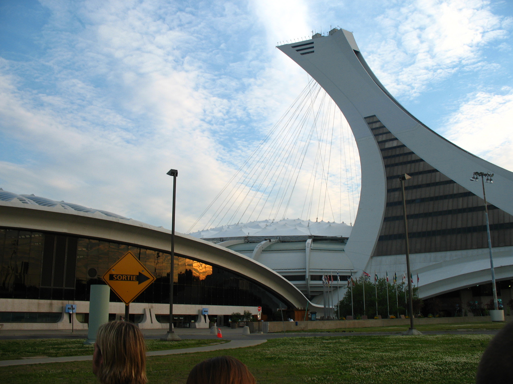
Orientation: Where You Are and How the Pieces Fit Together
Mercier–Hochelaga-Maisonneuve sits at the southeastern end of the Island of Montreal. It is made up of three areas — Hochelaga-Maisonneuve, Mercier-Ouest (Longue-Pointe) and Mercier-Est (Tétreaultville) — each with its own commercial character. The Saint Lawrence River forms its southern edge, and the borough is bisected by Autoroute 25, which also carries the Montreal entrance to the Louis Hippolyte Lafontaine Tunnel.
For a visitor, the practical upshot is that this is a large, mostly residential and industrial east-end borough rather than a compact tourist core. Getting around comfortably means leaning on the metro and bus network for longer hops, and walking for the last stretch.
The Main East–West Arteries
Almost all surface travel in the borough runs along a handful of parallel east–west streets. Knowing these names makes reading a bus map or giving a taxi driver directions much easier:
- Rue Notre-Dame
- Rue Sainte-Catherine Est
- Rue Ontario
- Rue Hochelaga
- Avenue Pierre-De Coubertin
- Rue Sherbrooke
Place Versailles shopping centre sits at the intersection of Rue Sherbrooke Est and Autoroute 25, a useful landmark for orienting yourself in the eastern part of the borough.
Metro: Your Backbone for Reaching the Borough
Mercier–Hochelaga-Maisonneuve is served by the eastern end of the green line of the Montreal metro. The Honoré-Beaugrand and Radisson stations are connected to important bus termini, which makes them natural gateways if you are arriving from elsewhere in the city and transferring to a local bus.
Within the borough, Station Pie-Ix (at Pie-Ix and Pierre-De Coubertin) and Station De L'Assomption are the stations you are most likely to use. Both are within a short walk of nearby destinations, and Pie-Ix in particular sits close to the Musée du Château Dufresne, Parc Marie-Victorin and Collège de Maisonneuve.
Montreal's transit system as a whole is built around four modes — bus, train, metro and shuttle — operated by more than one agency, so a single trip can involve more than one operator.
Buses and Other Public Transport
Buses fill in everywhere the metro does not reach, and in this borough that is a lot of ground. Several routes run through the area, including the 185, 139, 355, 97, 439, 364, 67 and 85. Some are oriented east–west, others north–south, and at least one (the 439) runs north toward Cégep Marie-Victorin.
Bus stops cluster tightly around the metro stations and along the main arteries. The stops at Sherbrooke and Pie-Ix, and at Station Pie-Ix itself, are convenient interchange points where you can switch between bus and metro.
Service runs late: buses and metro both operate into the small hours, and early-morning service begins before dawn. If you are out in the evening, check the last departure for your specific route rather than assuming a single system-wide closing time.
Buying Tickets and Passes
Fares, passes and prices are handled through the transit agencies' own channels and apps rather than being posted at every stop, so the simplest approach is to sort out your ticket or pass before you travel — at a metro station or through the official app — and then reload as needed. Because more than one agency operates in the region, a pass that covers your whole journey is worth confirming at the point of purchase.
Taxis and Ride-Hailing
Taxis and ride-hailing are a reasonable fallback for point-to-point trips, particularly late at night or when your destination sits away from a bus line. Given the borough's size and its industrial zones, a car-based trip can save real time on cross-borough journeys that would otherwise require a transfer.
Walking and Bike-Share
Walking works well for local errands and for the clusters of attractions around the metro stations — the Château Dufresne, Parc Marie-Victorin and Collège de Maisonneuve are all within easy reach of Pie-Ix. Bike-share stations (Bixi) are also present in the area, which is a practical option along the flatter riverside and arterial corridors.
Be realistic about distances, though: the borough is oblong and stretches a long way east to west, and Autoroute 25 cuts through it, dividing Mercier into western and eastern districts. Some trips that look short on a map are not pleasant walks.
Getting In from the Airport
Montreal's main airport lies off the island, so the trip into the city is a genuine journey rather than a quick hop. In practice you have two broad choices: a taxi or ride-hailing car direct to your address, or a combination of airport shuttle and the city's metro and bus network. If you are heading specifically to Mercier–Hochelaga-Maisonneuve, plan on the final leg being a metro ride to the eastern green line followed by a local bus or a short taxi ride, since the borough sits at the far eastern end of the island rather than in the downtown core.
What's Coming: The REM de l'Est
A major light-rail project, the REM de l'Est, has been planned to connect east and northeast Montreal to downtown. It is a fully automated electric light rail metro, and the Mercier–Hochelaga-Maisonneuve sector was slated to receive a set of elevated, universally accessible stations along Notre-Dame Street and Sherbrooke Street East, with interchanges to the existing green line at Assomption and Honoré-Beaugrand and a connection to the Pie-IX bus rapid transit corridor.
As of the planning documents, the project was still moving through design and public consultation, so it is not something to rely on for a current trip — but it is worth knowing about, because it is designed to substantially cut travel times between the borough and the rest of the city.
Practical Summary
- Metro first: use the green line to reach the borough, then transfer at Honoré-Beaugrand, Radisson, Pie-Ix or Assomption.
- Buses for the last mile: routes like the 185, 139, 97, 439, 67 and 85 cover the gaps the metro leaves.
- Know your arteries: Notre-Dame, Sainte-Catherine Est, Ontario, Hochelaga, Pierre-De Coubertin and Sherbrooke run east–west and anchor the bus network.
- Sort your fare early: buy or load a ticket or pass before you travel, since multiple agencies operate in the region.
- Walk where it makes sense: the area around Pie-Ix is compact and pleasant on foot; the borough as a whole is not.
- From the airport: expect a taxi or ride-hailing car, or a shuttle-plus-metro combination, with a final bus or taxi leg to your east-end address.