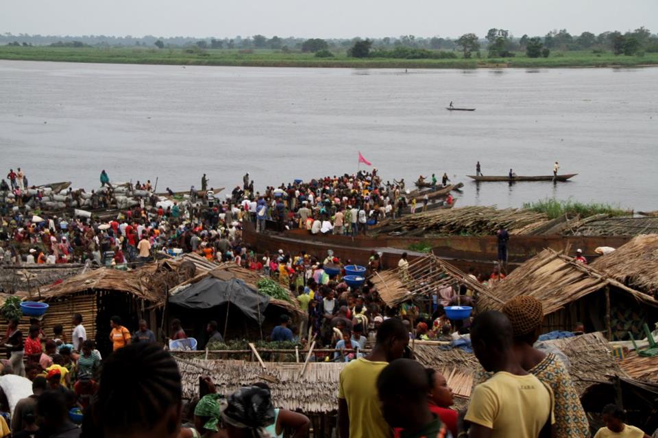
Stand on the riverbank south of town and you are standing at a stone Henry Morton Stanley placed to mark where he believed the equator crossed the Congo River. The "Equator Stone" is still there, and the town hall sits about 4 km north of the line it commemorates. Mbandaka is a river city on the east bank of the Congo, below the mouth of the Ruki, and the water is the thread that runs through any visit.
This guide suits travellers who are already in the Democratic Republic of the Congo, or who are willing to reach Mbandaka by the four to seven day river barge journey from Kinshasa or Boende, or by the hour-long flight from Kinshasa to Mbandaka airport. It is not a city of polished attractions. Years of war and neglect have left large areas without electricity or running water, and most streets and avenues are unpaved dirt roads. Plan for that, and the places below reward the effort.
What follows covers the sights the sources describe, then a single-day route that strings them together, then practical questions.
Top things to do in Mbandaka
1. Botanic Garden of Eala
About 7 km east of the town centre, at nearby Eala, lies one of the finest botanical gardens of central Africa. Founded in 1900, it holds between 4,000 and 5,000 species across roughly 370 hectares, divided into special collections, forest, marsh and savanna "Euobe".
Go knowing what you are walking into: the garden is neglected and unfenced, and subject to illegal logging. The last catalogue of its holdings was published in 1924. Combine it with the Catholic mission station at Bamanya, which lies further east along the same road.
2. Catholic Mission station and Central African history research centre of Bamanya
At the Catholic mission station of Bamanya, about 10 km east of Mbandaka, is a large research centre for Central African history, originally set up by Fathers Gustaaf Hulstaert and Honoré Vinck.
This is the stop for anyone interested in the documentary record of the region rather than scenery. It pairs naturally with the Botanic Garden of Eala on the same eastward run out of town, so treat the two as one half-day rather than two separate trips.
3. Ligne de l'equateur
The equator line is listed as a tourist attraction in its own right. Mbandaka lies only a few kilometres from the equator, and the town hall stands about 4 km north of it.
Set aside time to seek out the line itself rather than only the stone by the river. The two belong together: Stanley's marker at the riverbank and the line the town is built around tell the same story of a city placed deliberately on the map.
4. The Equator Stone
Stanley placed a large "Equator Stone" near the riverbank south of the city to mark the point where he believed the equator crossed the river, and it remains there today.
Go for the river as much as the stone. This bank of the Congo is the reason the city exists, and it is the easiest place to understand how Mbandaka sits below the mouth of the Ruki at the centre of the Tumba-Ngiri-Maindombe wetland.
5. First Habitat for Humanity International housing project
Mbandaka is the home of the world's first project of Habitat for Humanity International. Founder Millard Fuller served as a missionary with the Disciples of Christ Church in Mbandaka from 1973 to 1976, and the housing project he started here in 1973 became the original project of Habitat for Humanity when he founded the organisation upon his return to the United States.
This is a site of organisational history rather than a monument, so approach it as a piece of the city's modern story. It sits well alongside a general walk through the streets, which are mostly unpaved dirt roads.
6. The Congo River bank and the barge landing
Mbandaka is linked to Kinshasa and Boende by a four to seven day river barge journey, and the river is the city's main artery. Watching the barges is one of the most direct ways to grasp where you are.
Time this for the part of the day when you would otherwise be waiting around, and pair it with the Equator Stone, which is on the same riverbank south of the city.
7. The town hall and the equator line it sits near
The town hall is about 4 km north of the equator, which makes it a useful orientation point in a city whose streets are largely unpaved. The original city hall, completed in 1947, was destroyed by fire in 1963, so what you are locating is the position, not the building of that era.
Use it as the northern anchor of a walk that takes in the equator line, and note that the city was founded in 1883 by Henry Morton Stanley under the name Équateurville.
8. The city streets and markets on foot
Mbandaka is largely populated by people of the Mongo ethnic group, though people from many different tribes and regions live in the city, and the main languages spoken are Lingala, French and Mongo.
Walking is the honest way to see a city where most streets and avenues are unpaved dirt roads and large areas lack electricity or running water. Keep expectations practical and let the streets be the point rather than a route to somewhere else.
If you only have one day
Morning. Head east out of town to the Botanic Garden of Eala, about 7 km from the centre, and walk what you can of its collections, forest, marsh and savanna. Continue to the Catholic Mission station and Central African history research centre of Bamanya, roughly 10 km east of Mbandaka, and spend time with the research centre's holdings on Central African history.
Afternoon. Return to the city and find the Ligne de l'equateur, then walk or ride north to the town hall, which sits about 4 km north of the equator. Use the two together to fix the line in your mind before you go to the river.
Evening. Finish at the Equator Stone near the riverbank south of the city, where Stanley placed his marker, and stay for the Congo River bank and the barge landing as the light goes. If time allows earlier in the day, fit in the First Habitat for Humanity International housing project, which is best seen as part of a walk through the streets.
Frequently asked questions
How do I get to Mbandaka?
Mbandaka is home to Mbandaka airport, and Kinshasa is an hour's plane ride away. By river, the city is linked to Kinshasa and Boende by a four to seven day barge journey.
What languages will I hear in Mbandaka?
The main languages spoken in Mbandaka are Lingala, French and Mongo.
What should I expect from the city's infrastructure?
Years of war and neglect have caused deterioration of the city infrastructure. Large areas of the city are without electricity or running water, and most of the streets and avenues are unpaved dirt roads.
When is the driest time to visit?
Mbandaka has a tropical rainforest climate and does not have a dry season. January is the driest month, and September is the wettest. Temperatures stay relatively constant through the year.
Decide whether you are arriving by air or by barge, then build your days around the riverbank, the equator line and the road east to Eala and Bamanya.