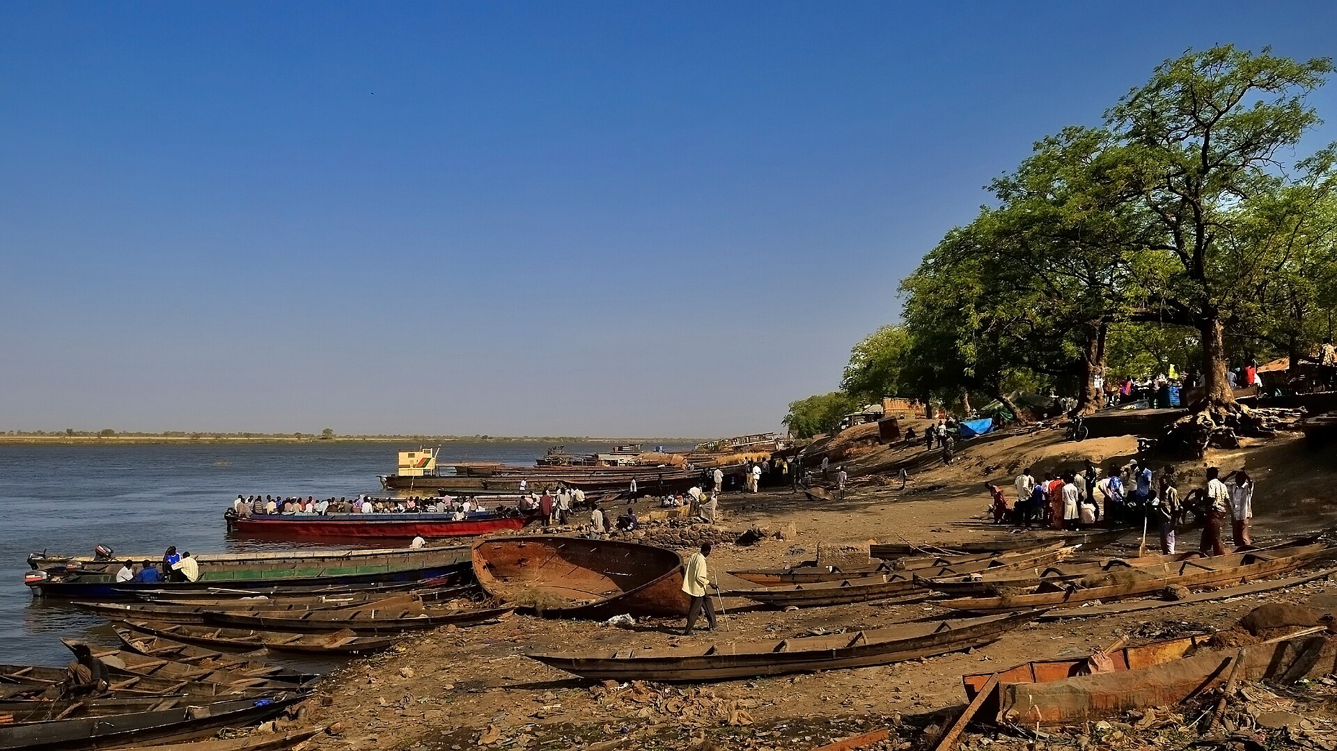
Malakal
Introduction
Malakal is a city in South Sudan, sitting along the White Nile River. It serves as the capital of Upper Nile State, in the Greater Upper Nile region, and as the headquarters of Malakal County. From the 1970s until the late 1990s, it also served as the headquarters of the Upper Nile Region.
Before you go
Malakal was long South Sudan's second largest city, but it was destroyed by years of civil war following the 2011 split between Sudan and South Sudan. What remains is under the control of government forces (the SPLA). Hospitals and much of the key infrastructure have been destroyed, and little is left beyond ashes and wreckage: whatever the fighting did not raze has been lost to looting and vandalism.
As a result, the ruined town itself is likely not safe to visit without a UN or military escort. Before you go, read the warning on the South Sudan article for information on the security situation, and plan your trip around that advice rather than around anything the city itself can offer.
Getting there
Malakal Airport (MAK) was once South Sudan's second international airport, with flights from Addis Ababa and Khartoum, plus a domestic route from Juba that was often booked full, so early reservations were advised. Later, the airport became inaccessible for long periods due to fighting. As of 2016, the airfield is functional and reachable by United Nations charter flights and military supply planes.
Barges on the White Nile were a primary means of transportation, carrying passengers from Maloot with travel times varying from six to 24 hours. By road, conditions were poor even before the conflict: roads ranged from bad to non-existent, and during the rainy season all roads to Malakal became unusable for ordinary vehicles. A few slow repair efforts were underway, especially toward the Ethiopian border, but the situation has worsened since, with little usable infrastructure remaining.
Getting around
Getting around Malakal is not a matter of choosing between options so much as accepting how few there are. There is no rail, metro or tram network, no scheduled city bus service, no route maps or timetables, and no described taxi fleet or ride-hailing apps. Do not count on flagging anything down. Arrange every vehicle in advance through whoever is hosting you — a trusted local contact, an organisation, or your accommodation — and confirm the arrangement before you travel rather than on arrival.
Walking is the one mode you can generally rely on for short distances, but conditions are difficult: hot temperatures year-round, a hottest stretch from February to May with April the peak, a humid wet season peaking in August, and mud underfoot in the rainy months. Keep walks short and time them for the cooler parts of the day. Arriving by air means treating your transfer as pre-arranged, since commercial service at Malakal International Airport has been disrupted and the airfield has at times been limited to United Nations and military flights. Road travel is severely constrained, especially in the rainy season, when roads into the city become unusable for ordinary vehicles; river transport by barge along the White Nile is an alternative where it is running.
Where to stay
Malakal offers very little in the way of established accommodation, so plan your stay around the town's basic guesthouses and whatever lodging the local hospitality sector can provide. Options are limited and standards are simple, so set your expectations accordingly and confirm availability before you arrive.
Food & drink
The source material for Malakal's food and drink scene is empty, so there is nothing to describe here.What to see and do
There is no sourced information available for what to see and do in Malakal, so this section cannot be written without inventing places, activities or details that the source does not contain.When to go
Malakal has a hot semi-arid climate with two distinct seasons, and temperatures stay hot all year. The dry season runs from November to March, with almost no rain and none at all in December and January. Humidity is at its lowest then, and December gets the most sunshine of the year. This is a hot, dry stretch, and the heat builds toward its peak by the end of the period.
The hottest time of year falls from February to May, just before the wet season begins, with April the hottest month. Expect intense heat, though humidity stays low early on before the rains arrive — plan around the heat rather than against it. The wet season brings much higher humidity and frequent, heavy rain that is likely to affect travel and outdoor plans. July and August are the coolest months by average temperature, and July gets the least sunshine of the year.
Three days in Malakal
Day one: Arrive at Malakal International Airport (MAK), the gateway to Upper Nile State, with connections from Addis Ababa, Khartoum and Juba. Settle into Malakal town, the capital of Malakal County, and take your bearings along the White Nile River, which defines the town's geography and daily life. In the afternoon, arrange a walk through the streets to get a feel for the town's character, keeping in mind that Malakal has been shaped by conflict and the presence of the SPLA, the UN and United Nations peacekeepers, as well as hospitals and other services that serve the wider Upper Nile Region.
Day two: Use the morning to explore the riverside, where barges on the White Nile connect Malakal to other parts of South Sudan and beyond. The river is central to transport and trade here, and watching activity along the bank gives you a sense of how goods and people move through this part of the Greater Upper Nile. Later, visit Maloot, a nearby settlement, to see a different side of the area. Keep your plans flexible, as services and access can change.
Day three: Before departing, take a final walk through Malakal and reflect on its position at the crossroads of the Upper Nile Region, with links north to Sudan and south to the rest of South Sudan. If your schedule allows, arrange onward travel by air from Malakal Airport or by river, depending on conditions. The best time to visit is during the drier months from February to May, while April and August bring heavier rain; arriving in the cooler, drier season makes getting around easier.