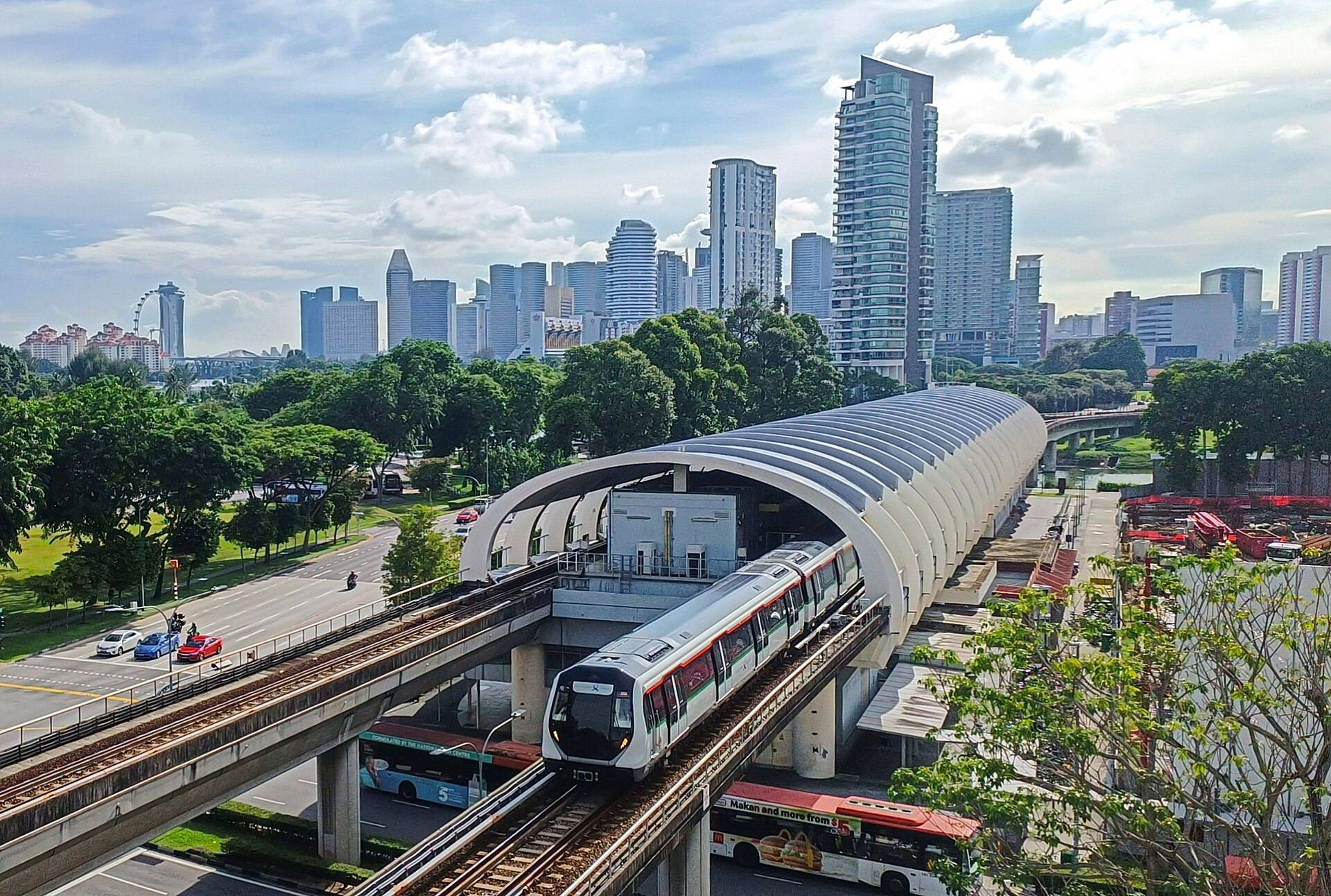
Kallang
Introduction
Kallang is a planning area and residential zone in the Central Region of Singapore. It is a lived-in part of the city rather than a tourist district, so you should expect a straightforward residential setting.
Getting around
Kallang sits in Singapore's Central Region around the Kallang River, bordering the Downtown Core to the southwest, Rochor and Newton to the west, Geylang to the east, and Marina East to the south. That central position is your main practical advantage: districts you might treat as separate destinations, Little India and Kampong Glam among them, spill over into Kallang, so you can cross into the planning area without noticing. The Singapore Sports Hub, home to the National Stadium and the Singapore Indoor Stadium, anchors the area on the eastern bank of the Kallang Basin.
The metro (MRT) is the backbone of getting around, with colour-coded lines connecting the airport, the city centre and the outlying areas; fares are distance-based and trains run every few minutes at peak and only slightly less often off-peak, from roughly the early morning until around midnight, a little later on some nights. Buses reach places the metro does not and use the same card — tap in and tap out on both, or you are charged a maximum fare. Use a single EZ-Link card, a contactless bank card via SimplyGo, or the Singapore Tourist Pass across metro and buses alike. Eating, drinking and carrying durian on the metro are prohibited, with fines attached, and the air-conditioning is strong, so carry a light layer. Grab is the dominant ride-hailing app with upfront fares, and metered taxis are widely available and street-hailable; expect surge pricing at peak hours and when it rains, and note that taxis and ride-hailing, along with night buses, are how you keep moving once the metro stops around midnight.
Kallang's terrain is flat and low, so walking is comfortable in principle, but midday heat means it is sensible to walk in the early morning or evening. Covered walkways — underground links and overhead bridges — connect stations, malls and buildings in the city centre, and the Park Connector Network links parks and nature reserves for longer recreational walks. The Kallang River meanders through the area, crossed by bridges including the Merdeka Bridge, the Benjamin Sheares Bridge and the Tanjong Rhu Footbridge, and the enclosed Kallang Basin is a pleasant area to walk, particularly in the cooler hours. From Changi Airport, the East-West line is the cheapest and most straightforward option if you are travelling light and arriving at a sensible hour; with luggage or a late arrival, take a taxi or Grab instead. Pick up a tourist SIM card at the airport kiosks on arrival to make maps, ride-hailing and bus navigation easier.
Three days in Kallang
Day one: Start in Kallang itself, getting your bearings along the Kallang River and the Kallang Basin. The Singapore Sports Hub anchors the area, with the National Stadium and Singapore Indoor Stadium giving you a sense of the district's scale. To get around, the MRT and buses serve Kallang and the wider Central Region; use an EZ-Link card, SimplyGo or the Singapore Tourist Pass for fares, or hail a Grab if you prefer door to door. Eating options are spread through the neighbourhood, so build your first day around the river and the stadium surrounds rather than rushing between sights.
- Kallang River and Kallang Basin
- Singapore Sports Hub, National Stadium and Singapore Indoor Stadium
- MRT, buses, EZ-Link, SimplyGo, Singapore Tourist Pass or Grab for transport
Day two: Follow the water. The Kallang River links into the Park Connector Network, and covered walkways help when the weather turns warm and humid or wet. Cross or admire the Merdeka Bridge, the Benjamin Sheares Bridge and the Tanjong Rhu Footbridge, each giving you a different view of the river and basin. Keep the pace easy and let the connections between Kallang and the neighbouring areas set your route.
- Kallang River and the Park Connector Network
- Merdeka Bridge, Benjamin Sheares Bridge and Tanjong Rhu Footbridge
- Covered walkways for shelter
Day three: Push out into the surrounding districts. Little India and Kampong Glam are within reach for food and streetscape, while Rochor, Newton, Geylang, Marina East and the Downtown Core sit nearby in the Central Region. From Changi Airport you can reach the east side of the city and connect onward to Kallang, so this day works well if you are heading to or from the airport. Pick your stops and use the MRT, buses or a Grab to link them.
- Little India and Kampong Glam
- Rochor, Newton, Geylang, Marina East and the Downtown Core
- Connections from Changi Airport