Tiaret
Introduction
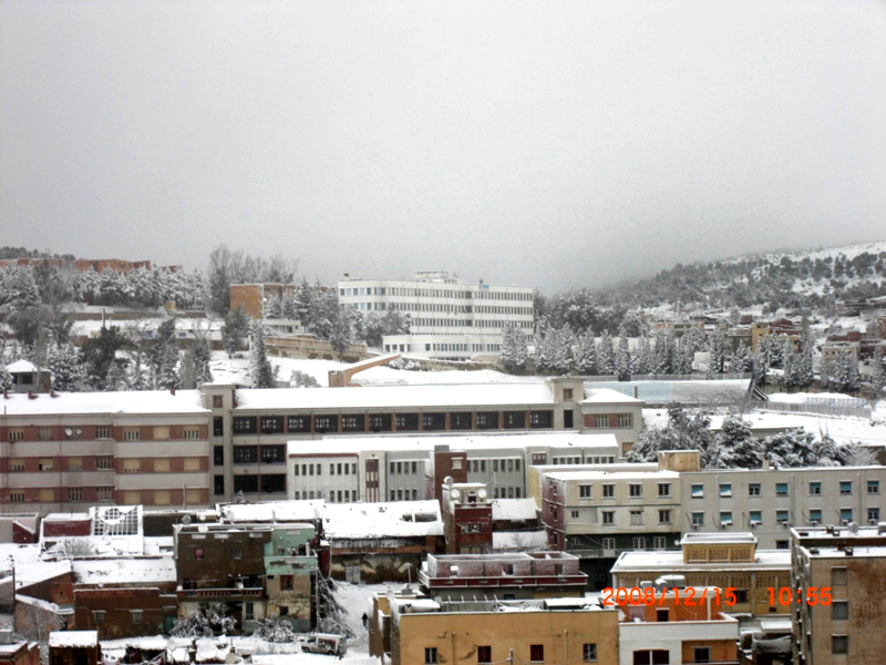
Tiaret, also known as Tahert, is a major city in northwestern Algeria that lends its name to the surrounding farming region of Tiaret Province. It sits in the western Hautes Plaines, within the Tell Atlas, southwest of Algiers and roughly 150 km from the Mediterranean coast.
The city is served by Abdelhafid Boussouf Bou Chekif Airport, and its position within a wider agricultural province shapes the character of the area you'll be travelling through.
Getting around
Tiaret has no metro, no tram, and no working passenger rail line, so plan on moving around by road. Urban buses run the city and its outskirts, while coaches handle longer intercity and inter-wilaya journeys; the two often leave from different points and serve different purposes, so it helps to be clear which one you want when asking for tickets or directions. Urban services are operated by private companies rather than a single municipal operator, which means ticketing is arranged route by route instead of through a citywide pass.
Taxis are a common way to get around Algerian cities and are a natural complement here for trips that buses do not cover conveniently; confirm fares locally before you set off. The modern town is built around a French redoubt, giving a compact historic core that lends itself to walking, but beyond the centre the city sits in a mountainous landscape at high elevation, so use buses or taxis for longer journeys. If you arrive by air at Abdelhafid Boussouf Bou Chekif Airport, there is no dedicated shuttle, bus route, or rail link into the city described, so arrange ground transport on arrival rather than expecting a fixed airport express service.
When to go
Tiaret has a Mediterranean climate, with a wetter winter and a drier summer. If you visit in winter, expect the wettest conditions of the year, with more rain than at other times. Days are cooler than the rest of the year, though the climate remains Mediterranean rather than severe.
Summer is the driest stretch of the year, as rainfall drops off sharply. It is also the warmest period, so plan your outdoor sightseeing for early or late in the day.
Three days in Tiaret
Day one: Start in Tiaret itself, in Tiaret Province, and get your bearings in the urban centre before heading out. Tiaret sits in the Hautes Plaines, between the Tell Atlas and the Mediterranean reach of Algeria, so the setting is high plain rather than coast. If you arrive by air, Abdelhafid Boussouf Bou Chekif Airport serves the city; taxis are the straightforward way in. Summer here is hot and dry, so plan your walking for the cooler ends of the day.
Day two: Give the day to Tahert, the historic name tied to this place and the reason Tiaret rewards a slower look. It is the older layer of the city's story, and it is best approached on foot, with time to read the ground rather than rush it. Algerian and French strands run through the region's history, and you will notice both in the way the city is laid out and spoken about. Keep the pace easy; the Hautes Plaines sun is unforgiving in summer.
Day three: Use the day to understand where you are. Look out across the Hautes Plaines toward the Tell Atlas, and remember that the Mediterranean is part of the same country but not of this landscape. If you have time before leaving, a taxi back to Abdelhafid Boussouf Bou Chekif Airport closes the loop. Days here are best spent slowly, moving between the urban centre and the open plain rather than ticking off stops.