Itapecerica da Serra
Introduction
Itapecerica da Serra sits in the Brazilian state of São Paulo, within the Metropolitan Region of São Paulo, roughly 23 miles southwest of the city of São Paulo itself. The municipality spreads across hilly ground at an altitude of about 920 metres above sea level, and its name is thought to come from the Tupi language, meaning "slippery stone," with *da Serra* adding "of the Mountains" in Portuguese. For a traveller, that puts Itapecerica da Serra in the orbit of greater São Paulo while keeping it at a remove from the capital, high enough in the hills to feel like its own place. It is a municipality rather than a resort town, so come expecting an everyday Paulista city in a mountain setting rather than a polished tourist circuit.Before you go
Itapecerica da Serra is a municipality in the state of São Paulo, Brazil. Before you go, it helps to know that the city sits within the Greater São Paulo area, so its climate and rhythms are tied to that region rather than to a standalone destination. Plan around the seasons as they are felt locally: summers are warm and humid with frequent rain, while winters are milder and can turn cool, especially at night.
Because the source material for this guide is limited, treat your planning as a starting point. Confirm transport connections, local events and any site-specific details through official municipal channels before you set out, and allow extra time for travel within the metropolitan region.
Getting there
Itapecerica da Serra sits within Greater São Paulo, so the most practical approach is through the city of São Paulo and its transport network. The source material for this guide does not detail specific routes, terminals or services, so confirm current connections locally before you set out.
Getting around
Itapecerica da Serra has no rail, metro or tram network of its own, so plan your movements around road transport rather than assuming you can arrive or get around by train. Buses are the main form of public transport, both for local trips within the municipality and for longer journeys toward the city of São Paulo, which lies roughly 23 miles to the northeast. Treat the bus as your link to the capital's rail and metro system, since no line serves the town directly. Fares, passes and payment methods are handled locally and regionally, so confirm current ticket options and where to buy them once you arrive instead of relying on pre-trip assumptions.
Taxis and ride-hailing services are a flexible alternative, useful for trips that are awkward by bus, for reaching specific addresses, and for the first leg of a journey toward São Paulo. Agree on the fare or confirm the app price before setting off. Walking works well for short distances in the town centre and for reaching nearby shops, services and bus stops, but the municipality is spread out, so treat it as a complement to vehicles rather than a way to cross the whole area. Keep ride-hailing apps handy for gaps in bus coverage and for early or late journeys.
Where to stay
Where you stay in Itapecerica da Serra is largely determined by how you arrive. Two of the city's hotels sit directly on the BR-116/Régis Bittencourt highway — Hotel Serrano Park at km 285.5 and Hotel Terras Altas at km 292.5 — making them the practical choice if you are passing through by car and want a bed without detouring into town. If you would rather base yourself away from the highway, Hotel Del Verde sits on Estrada Pref. Bento Rotger Romingues, a quieter address within the city itself.Food & drink
For a meal, the city's eating options cluster along the BR-116/Régis Bittencourt highway corridor. Caminho do Sul sits at km 288, while Rancho do Vinho is a little further along at km 293.5. Away from the highway, d'Roça can be found on Estrada João Rodrigues de Moraes. For drinking, Rampas Chopp e Show shares the km 288 stretch of the BR-116/Régis Bittencourt, so you can pair a stop there with a meal at Caminho do Sul nearby.What to see and do
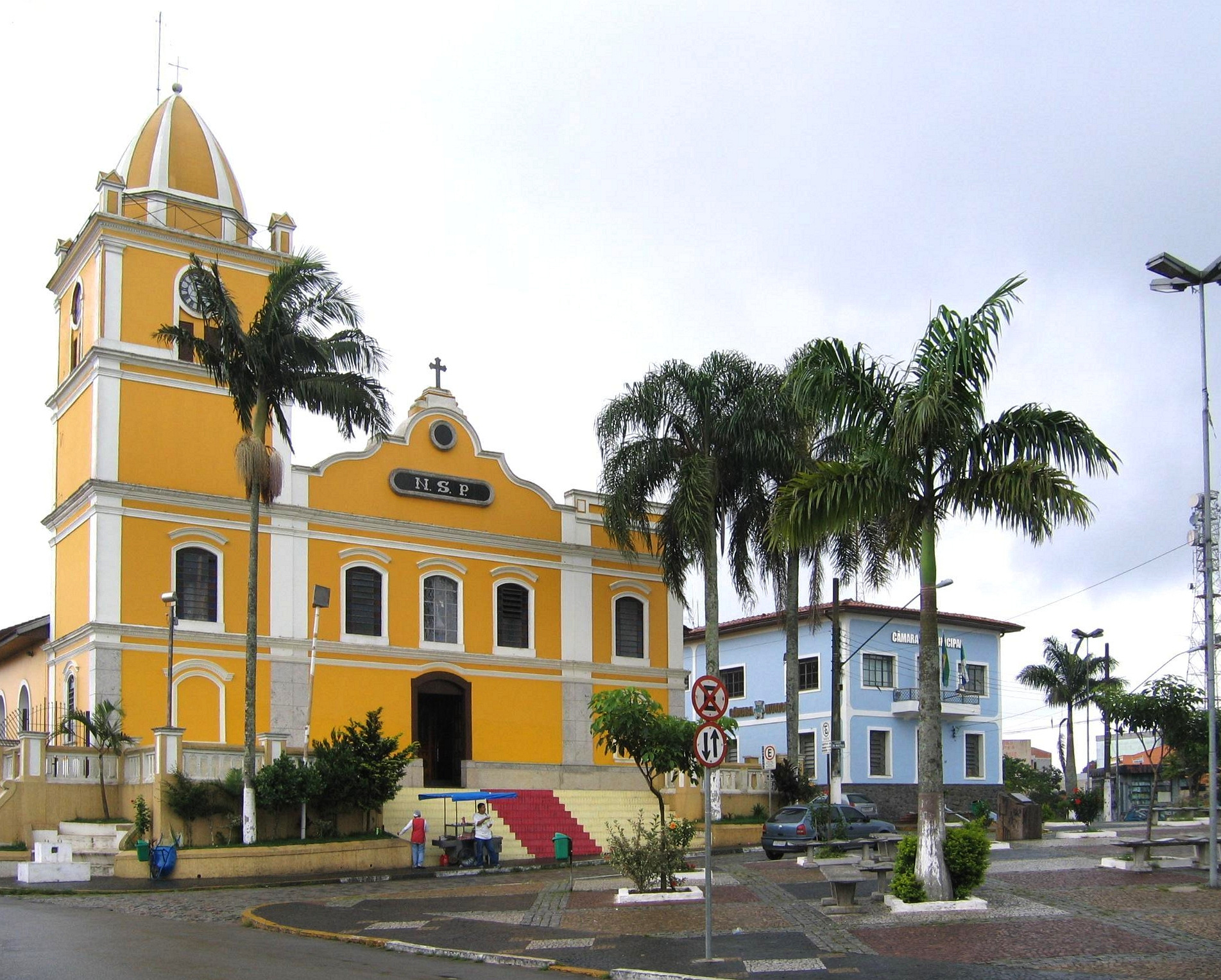
The town's main sight is the Igreja Matriz, the mother church that anchors the centre. Beyond that, the source material offers little on specific attractions, so plan to spend your time simply wandering the streets around the church and taking in the everyday rhythm of this part of the São Paulo countryside.Three days in Itapecerica da Serra
Day one: Base yourself in Itapecerica da Serra, a Paulista town in the Serra do Mar within the Metropolitan Region of São Paulo. The name comes from the Tupi language, and the Portuguese colonial layer sits over that older heritage. Begin on foot in the centre, then use taxis or buses to reach the surrounding green hills. Treat the day as an orientation: confirm fares and routes before you commit, and agree on prices with drivers in advance.
Day two: Head out along the BR-116, the Régis Bittencourt, which links the town to Greater São Paulo and the southern corridor. Walking remains the best way to read the town's character, so keep to the central streets and the quieter lanes. If you want a longer excursion, plan around the Estrada Pref. Bento Rotger Romingues and the Caminho do Sul, both of which thread through the rural edge. Because public transport thins out later, confirm your return before you set off.
Day three: Slow down. Rancho do Vinho and the Brazilian countryside around Itapecerica reward an unhurried morning, and the Serra backdrop stays with you. Two nights is enough for the town itself; three lets you add the outlying roads without rushing. Before leaving, confirm bus times back toward São Paulo and keep small change for fares. Away from the centre, taxis are the practical option, so agree the fare first.