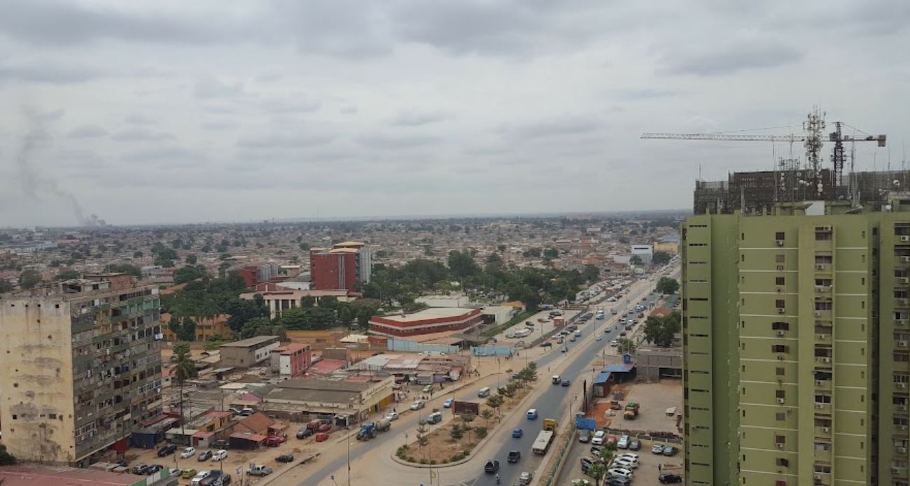
Rangel
Introduction
Rangel is one of the six urban districts of Luanda, Angola's capital, and counts among the older and more urbanized parts of the metropolitan area. It is a compact district, covering roughly six square kilometres.
You will find Rangel best known for Americo Boavida University Hospital and for its large sporting facilities, among them Pavilhão da Cidadela, Pavilhão Anexo and Pavilhão Anexo II.
Getting around
Within Angolan cities, public transport centres on two options: state-owned TCUL buses and private minibuses known as candongueiros. The minibuses are the more popular and affordable choice, running on fixed routes, though they can be crowded and are less comfortable than a taxi or a large interprovincial bus. Taxis are generally the more comfortable option when comfort matters more than cost; arrange one through your accommodation or a trusted local contact and agree the fare before you set off. Walking is best limited to areas you know or that come recommended locally, and it is not a practical way to cover long distances between towns. No metro or tram network is described for Angola, so do not expect one.
For travel between cities, reputable operators include Macon, Viação Cidrália, and Real Express, which market modern fleets, trained drivers, schedule adherence, and onboard movies on long routes. Real Express is headquartered at the Gamek terminal on Avenida 21 de Janeiro in Luanda, with other boarding points at Golf-Kimbango, Kikolo, KM 30, and Viana, and offers a loyalty app for accumulating travel points. Viação Cidrália runs from Kikolo and Gamek in Luanda, and its buses often depart one terminal then stop at the other roughly an hour and a half later before leaving the city — useful if you board at the second stop. Long-distance routes make mandatory town stops: Luanda–Benguela calls at Porto Amboim, Sumbe, Canjala, and Lobito, while Luanda–Huambo calls at Dondo, Quibala, and Alto Hama. Fares are not fixed and vary by route, date, advance booking, and capacity, so ask when booking. Main highways between major cities are well maintained, but rural roads and rainy-season conditions are worse, and delays, breakdowns, potholes, livestock on the roads, and erratic driving are all part of the picture — build in slack time. Rail, served by Ferrovia de Benguela, Ferrovia de Luanda, and Ferrovia de Moçâmedes, is best treated as an intercity option rather than a way to move around within a city, with schedules and ticketing confirmed locally.
Three days in Rangel
Day one: Start in Rangel itself, the Luanda neighbourhood that gives this guide its name. The area is defined by the Americo Boavida University Hospital and the Pavilhão, Pavilhão Anexo and Pavilhão Anexo II, so orient yourself around those landmarks. Within Angolan cities, taxis are the usual way to get around, and TCUL is one of the operators you can use. Walking is possible in places, but no single route covers everything, so plan your movements rather than drifting.
Day two: For longer hops, Macon, Viação Cidrália and Real Express are the names to look for. Gamek sits along the Avenida, and Janeiro, Golf, Kimbango and Kikolo are further points you can reach. Beyond the city, KM, Viana, Long, Benguela, Porto Amboim, Sumbe, Canjala, Lobito, Huambo, Dondo, Quibala and Alto Hama appear on the wider map. Fares vary, so agree them before you set off.
Day three: Use the main routes to connect what you have not yet seen, and keep the day flexible. The main thing is to treat Rangel as your base and let the transport network, whether TCUL, Macon, Viação Cidrália or Real Express, carry you outward. If you have time left, return to the Avenida and the landmarks around the Pavilhão complex before you finish.